
MyTopo
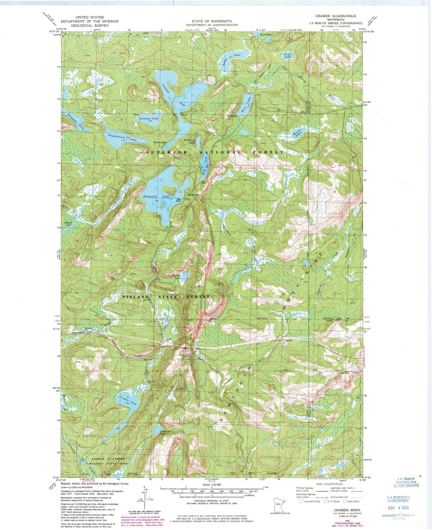
Classic USGS Cramer Minnesota 7.5'x7.5' Topo Map
Couldn't load pickup availability
Historical USGS topographic quad map of Cramer in the state of Minnesota. Map scale may vary for some years, but is generally around 1:24,000. Print size is approximately 24" x 27"
This quadrangle is in the following counties: Cook, Lake.
The map contains contour lines, roads, rivers, towns, and lakes. Printed on high-quality waterproof paper with UV fade-resistant inks, and shipped rolled.
Contains the following named places: Amenda Creek, Artlip Lake, Bonanza Lake, Cramer, Cramer Lake, Crooked Lake, Echo Lake, George H Crosby Manitou State Park, Goldeneye Lake, Hare Lake, Kowalski Lake, Martin Creek, Meme Lake, Morris Lake, Ninemile Campground, Ninemile Creek, Ninemile Lake, Paccini Lake, Pearl Lake, Shoepack Lake, Thunderbird Lake


