MyTopo
USGS Classic Cranberry Lake New York 7.5'x7.5' Topo Map
Couldn't load pickup availability
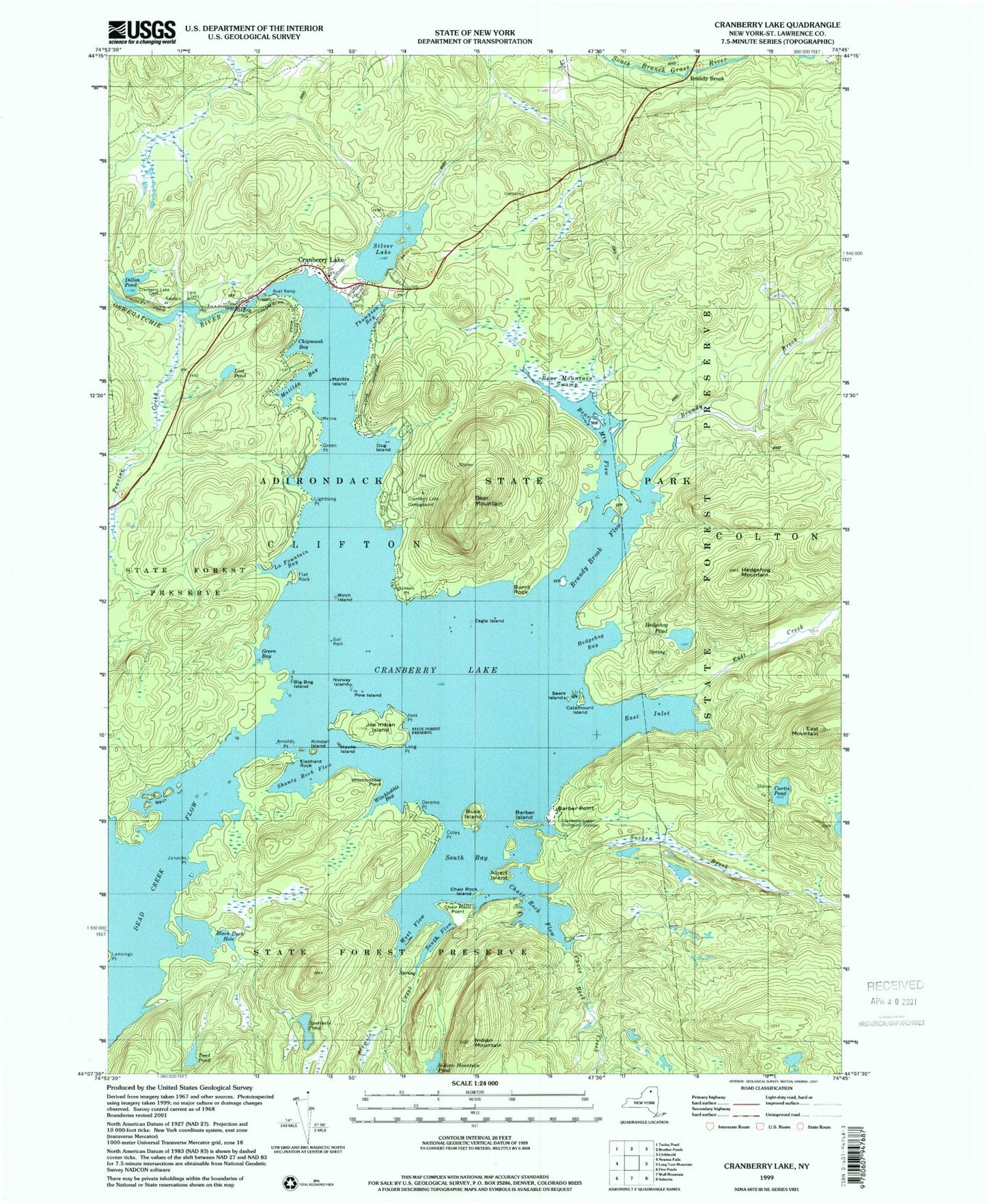
Historical USGS topographic quad map of Cranberry Lake in the state of New York. Scale: 1:24000. Print size: 24" x 27"
This quadrangle is in the following counties: St. Lawrence.
The map contains contour lines, roads, rivers, towns, lakes, and grids including latitude / longitude and UTM / MGRS. Printed on high-quality waterproof paper with UV fade-resistant inks.
Contains the following named places: Albert Island, Arnolds Point, Barber Island, Barber Point, Bear Mountain, Bear Mountain Flow, Bear Mountain Swamp, Big Bog Island, Birch Island, Black Duck Hole, Brandy Brook, Brandy Brook, Brandy Brook Flow, Buck Island, Burnt Rock, Catamount Island, Chair Rock Creek, Chair Rock Flow, Chair Rock Island, Chair Rock Point, Chipmunk Bay, Coles Point, Cranberry Lake, Cranberry Lake Biological Station, Cranberry Lake Campground, Cranberry Lake Cemetery, Curtis Pond, Deremo Point, Dillon Pond, Dog Island, Eagle Island, East Creek, East Inlet, East Mountain, Elephant Rock, Flat Rock, Green Bay, Green Point, Gull Rock, Hawks Island, Hedgehog Bay, Hedgehog Mountain, Hedgehog Pond, Indian Mountain, Indian Mountain Pond, Janacks Point, Joe Indian Island, Joes Point, Kimball Island, La Fountain Bay, Lansings Point, Lightning Point, Long Point, Lost Pond, Matilda Bay, Matilda Island, Norway Island, Peavine Creek, Pine Island, Sears Islands, Shanty Rock Flow, Silver Lake, Sixmile Creek, South Bay, South Flow, Spectacle Pond, Sucker Brook, Thompson Bay, Toad Pond, Union Point, West Flow, Witchhobble Bay, Witchhobble Point, Clifton Community Library, Cranberry Lake Census Designated Place, Cranberry Lake Volunteer Fire and Rescue, Cranberry Lake Post Office


