MyTopo
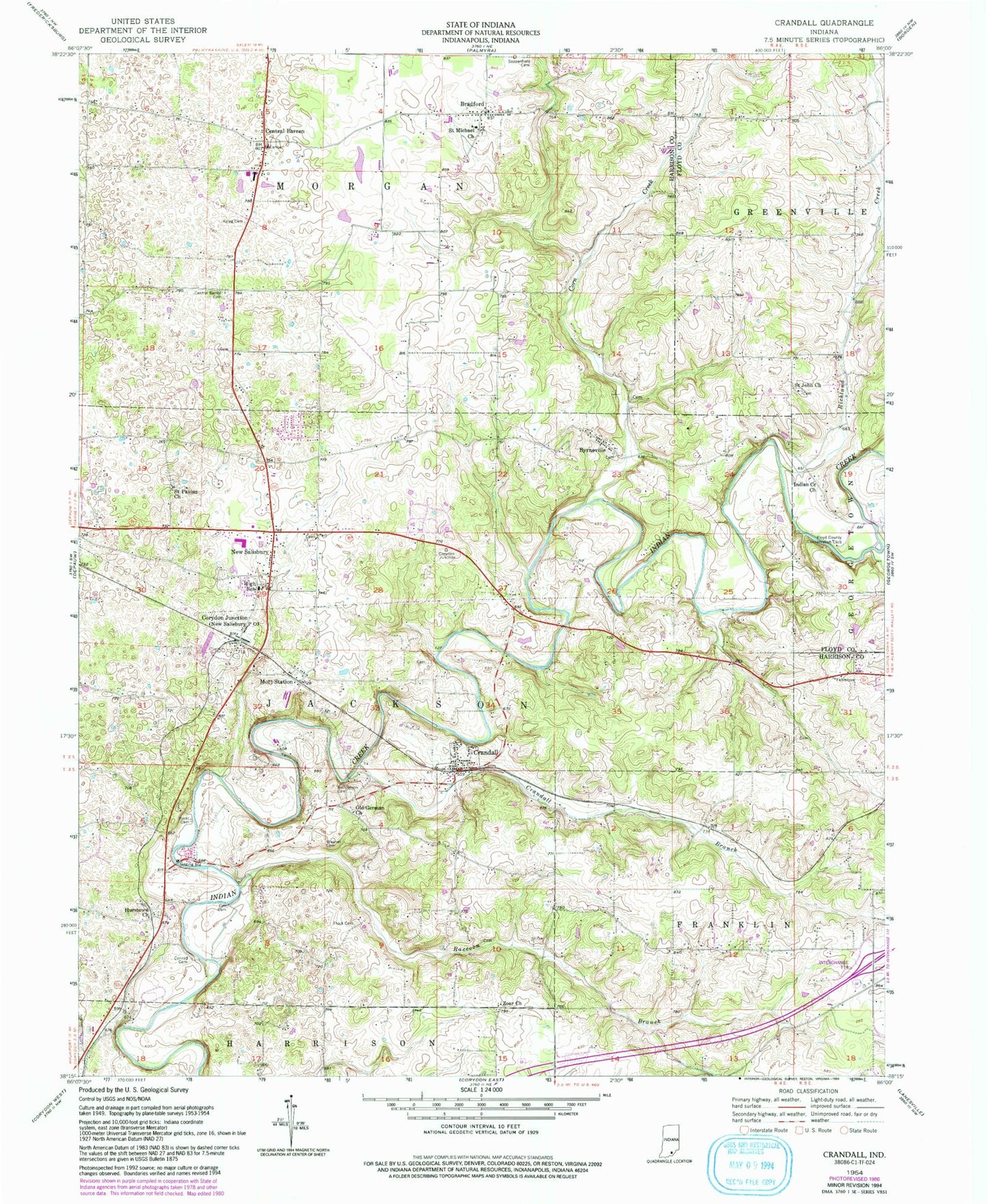
Classic USGS Crandall Indiana 7.5'x7.5' Topo Map
Couldn't load pickup availability
Historical USGS topographic quad map of Crandall in the state of Indiana. Map scale may vary for some years, but is generally around 1:24,000. Print size is approximately 24" x 27"
This quadrangle is in the following counties: Floyd, Harrison.
The map contains contour lines, roads, rivers, towns, and lakes. Printed on high-quality waterproof paper with UV fade-resistant inks, and shipped rolled.
Contains the following named places: Bethlehem Cemetery, Bradford, Byrne Field, Byrneville, Carr Cemetery, Central Barren, Central Barren Cemetery, Conrad Cemetery, Corn Creek, Corydon Junction, Crandall, Crandall Branch, Crandall Post Office, Flock Family Cemetery, Floyd Country Conservation Club, Georgetown Creek, German Methodist Cemetery, Hurst Cemetery, Hurstown Church, Indian Creek Church, Kaylor Cemetery, Mott Station, New Salisbury, New Salisbury Census Designated Place, New Salisbury Post Office, Old German Church, Raccoon Branch, Ramsey Volunteer Fire Department Station 2, Richland Creek, Saint John Church, Saint Michael Church, Saint Paulus Church, Sappenfield Cemetery, Town of Crandall, Township of Jackson, Wagner Cemetery, Zoar Church, ZIP Codes: 47114, 47124, 47161