
MyTopo
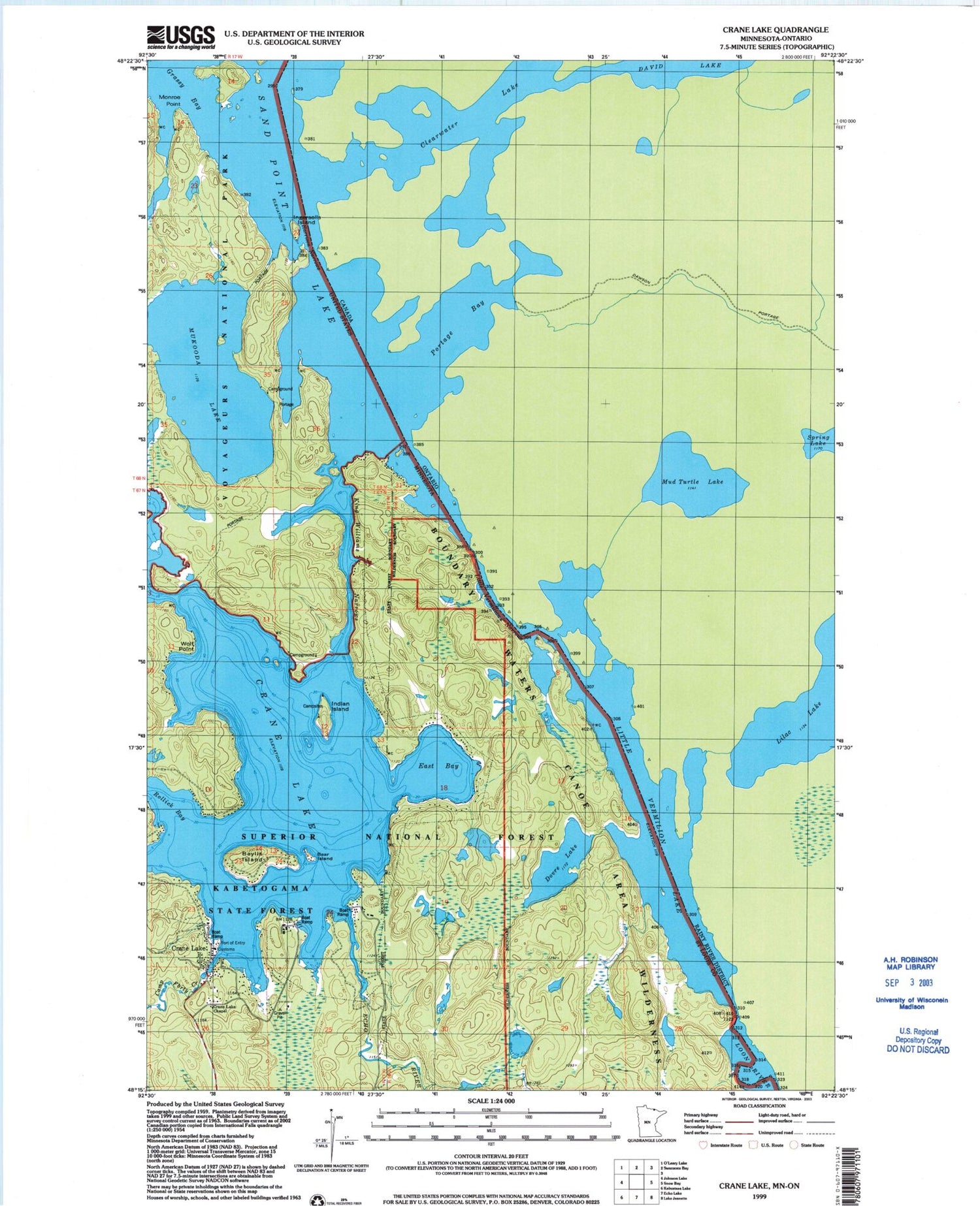
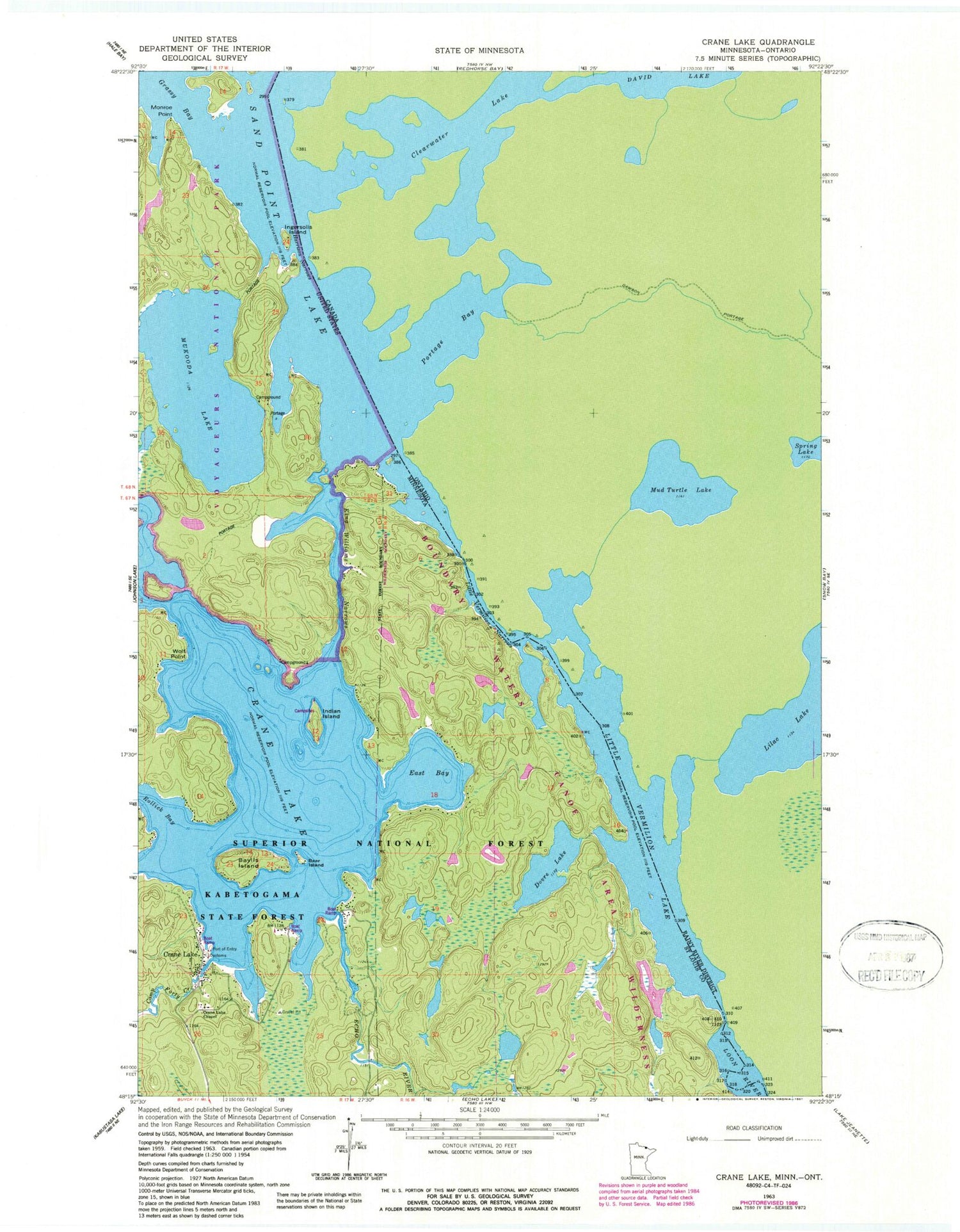
Classic USGS Crane Lake Minnesota 7.5'x7.5' Topo Map
Couldn't load pickup availability
Historical USGS topographic quad map of Crane Lake in the state of Minnesota. Typical map scale is 1:24,000, but may vary for certain years, if available. Print size: 24" x 27"
This quadrangle is in the following counties: St. Louis.
The map contains contour lines, roads, rivers, towns, and lakes. Printed on high-quality waterproof paper with UV fade-resistant inks, and shipped rolled.
Contains the following named places: Monroe Point, Sand Beach Campground, Scotts Seaplane Base, Baylis Island, Bear Island, Camp Forty Creek, Crane Lake, Crane Lake, Crane Lake Chapel, Dovre Lake, East Bay, Echo River, Harrison Narrows, Indian Island, Ingersolls Island, King Williams Narrows, Little Vermilion Lake, Little Vermilion Narrows, Loon River, Mukooda Lake, Rollick Bay, Wolf Point, Crane Lake Post Office, Harding Post Office (historical), Crane Lake Volunteer Fire Department, United States Customs and Border Protection - Port of Entry - Crane Lake


