MyTopo
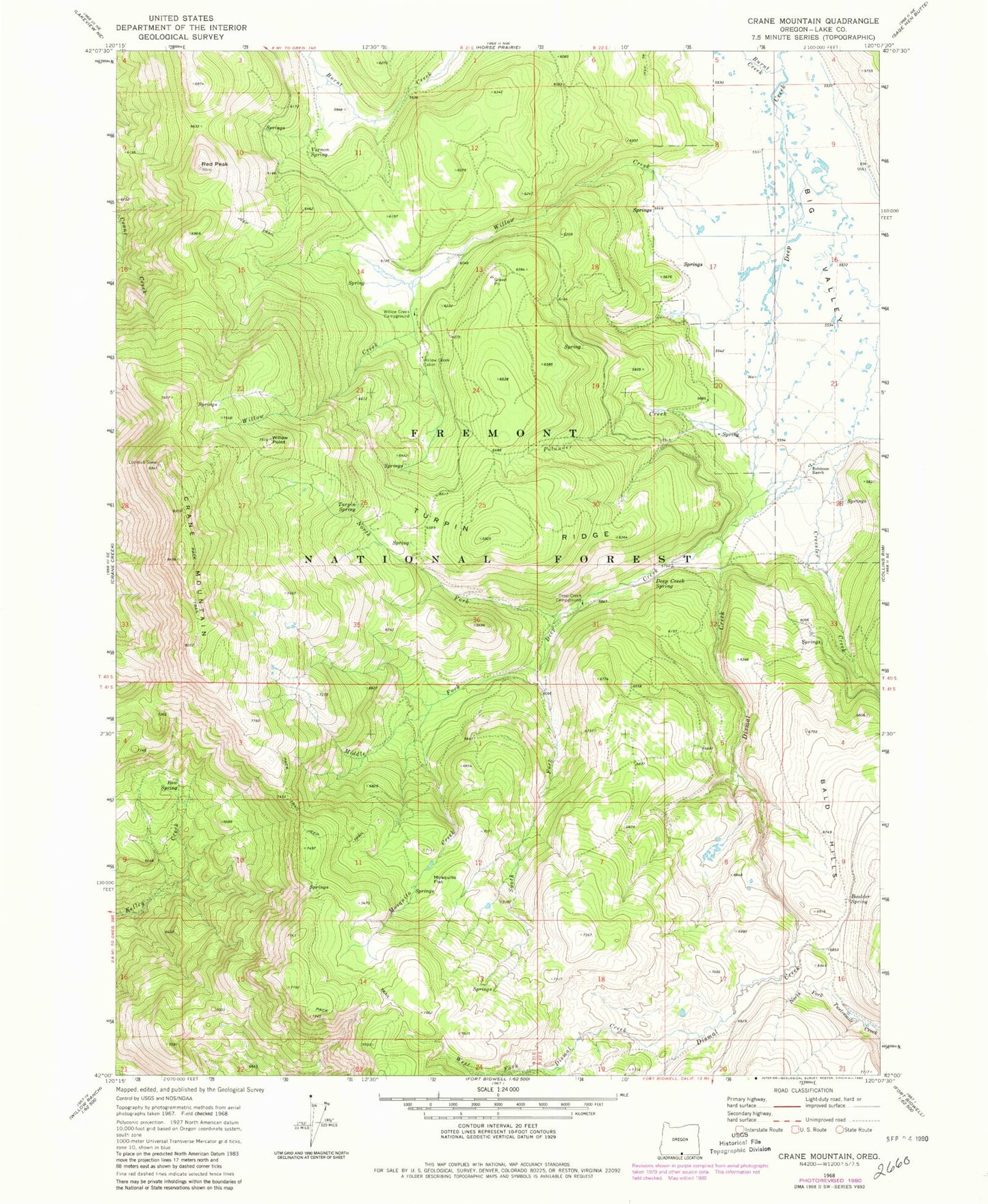
Classic USGS Crane Mountain Oregon 7.5'x7.5' Topo Map
Couldn't load pickup availability
Historical USGS topographic quad map of Crane Mountain in the state of Oregon. Map scale may vary for some years, but is generally around 1:24,000. Print size is approximately 24" x 27"
This quadrangle is in the following counties: Lake.
The map contains contour lines, roads, rivers, towns, and lakes. Printed on high-quality waterproof paper with UV fade-resistant inks, and shipped rolled.
Contains the following named places: Bald Hills, Boulder Spring, Bow Spring, Burnt Creek, Crane Mountain, Crane Mountain Viewpoint, Cressler Creek, Deep Creek Recreation Site, Deep Creek Spring, Dismal Creek, Dismal Creek Recreation Site, Middle Fork Deep Creek, Mosquito Creek, Mosquito Flat, North Fork Deep Creek, O'Keefe Meadow, Polander Creek, Red Peak, Robinson Ranch, South Fork Deep Creek, Turpin Ridge, Turpin Spring, Vernon Spring, West Fork Dismal Creek, Willow Creek, Willow Creek Cabin, Willow Creek Guard Station, Willow Creek Recreation Site, Willow Point