MyTopo
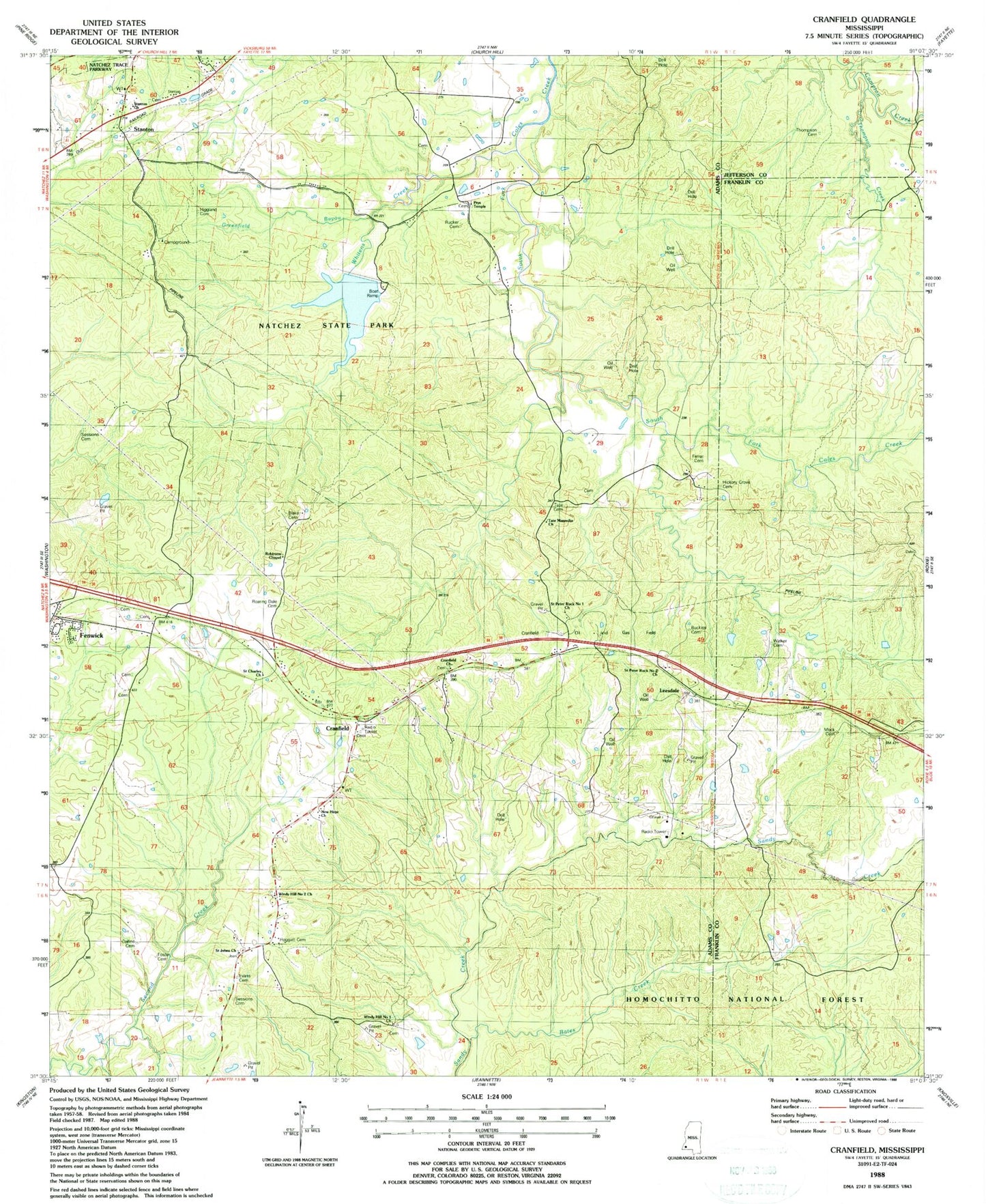
Classic USGS Cranfield Mississippi 7.5'x7.5' Topo Map
Couldn't load pickup availability
Historical USGS topographic quad map of Cranfield in the state of Mississippi. Map scale may vary for some years, but is generally around 1:24,000. Print size is approximately 24" x 27"
This quadrangle is in the following counties: Adams, Franklin, Jefferson.
The map contains contour lines, roads, rivers, towns, and lakes. Printed on high-quality waterproof paper with UV fade-resistant inks, and shipped rolled.
Contains the following named places: Bates Creek, Blake Cemetery, Buckles Cemetery, Cedar Grove Church, Collins Cemetery, Correctional Institution Adams County, Cranfield, Cranfield Church, Cranfield Oil and Gas Field, Evans Cemetery, Farrar Cemetery, Fenwick, Fenwick Oil Field, Forest Home Oil Field, Foster Cemetery, Galilee Oil Field, Greenfield Bayou, Helena, Hickory Grove Cemetery, Higgland Cemetery, Hoggatt Cemetery, Leesdale, Mock Cemetery, Moss Grove Oil Field, Natchez State Park, New Hope Church, Prys Temple, Roaring Dale Cemetery, Robinson Chapel, Rowardale School, Rucker Cemetery, Saint Charles Church, Saint Johns Church, Saint Marks Church, Saint Peter Rock Number 1 Church, Saint Peter Rock Number 2 Church, Saint Peters Church Number 1, Saint Peters Church Number 2, Sandy Bayou, Sessions Cemetery, Southwest Cranfield Oil Field, Stanton, Stanton Baptist Church, Stanton Church, Tate Cemetery, Tate Magnolia Church, Thompson Cemetery, Thompson Creek, Turners, Walker Cemetery, Whitens Creek, Windy Hill Number 1 Church, Windy Hill Number 2 Church