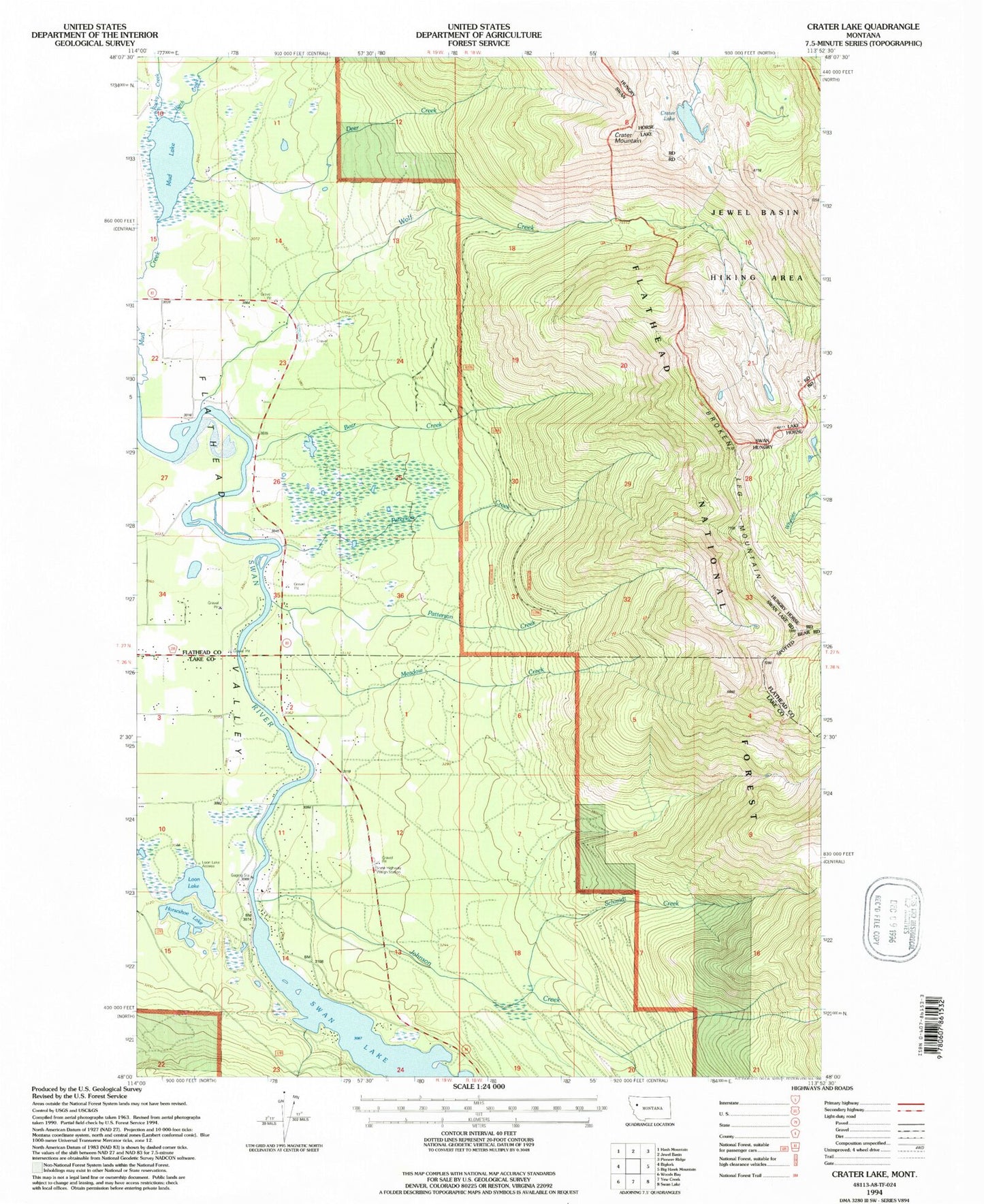
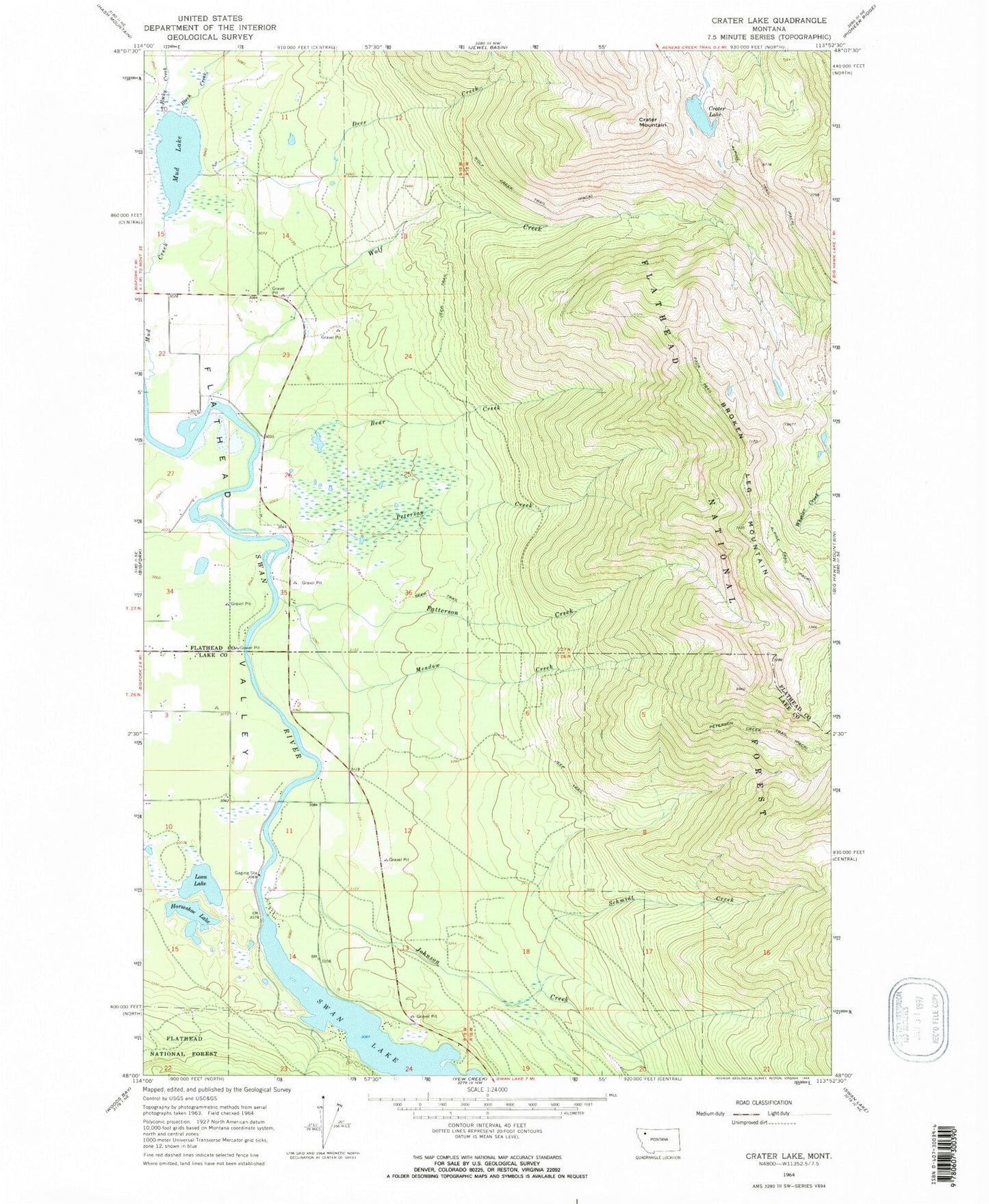
MyTopo
Classic USGS Crater Lake Montana 7.5'x7.5' Topo Map
Couldn't load pickup availability
Historical USGS topographic quad map of Crater Lake in the state of Montana. Map scale may vary for some years, but is generally around 1:24,000. Print size is approximately 24" x 27"
This quadrangle is in the following counties: Flathead, Lake.
The map contains contour lines, roads, rivers, towns, and lakes. Printed on high-quality waterproof paper with UV fade-resistant inks, and shipped rolled.
Contains the following named places: 26N19W11BBDD01 Well, Bear Creek, Bear Creek Village, Birch Creek, Broken Leg Mountain, Crater Lake, Crater Mountain, Deer Creek, Flathead Valley, Horseshoe Lake, Horseshoe Lake - Ferndale Fishing Access Site, Johnson Creek, Loon Lake, Loon Lake Access, Meadow Creek, Montana State Highway 83 Weigh Staton, Mud Lake, Patterson Creek, Peterson Creek, Peterson Creek Trail, Rocky Creek, Schmidt Creek, Swan River Fishing Access Site, Wolf Creek, Wolf Creek Trail