MyTopo
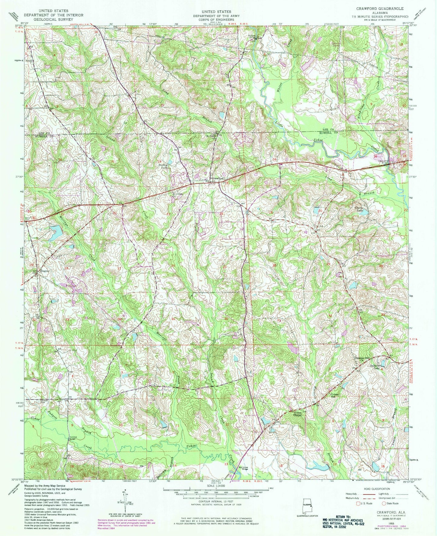
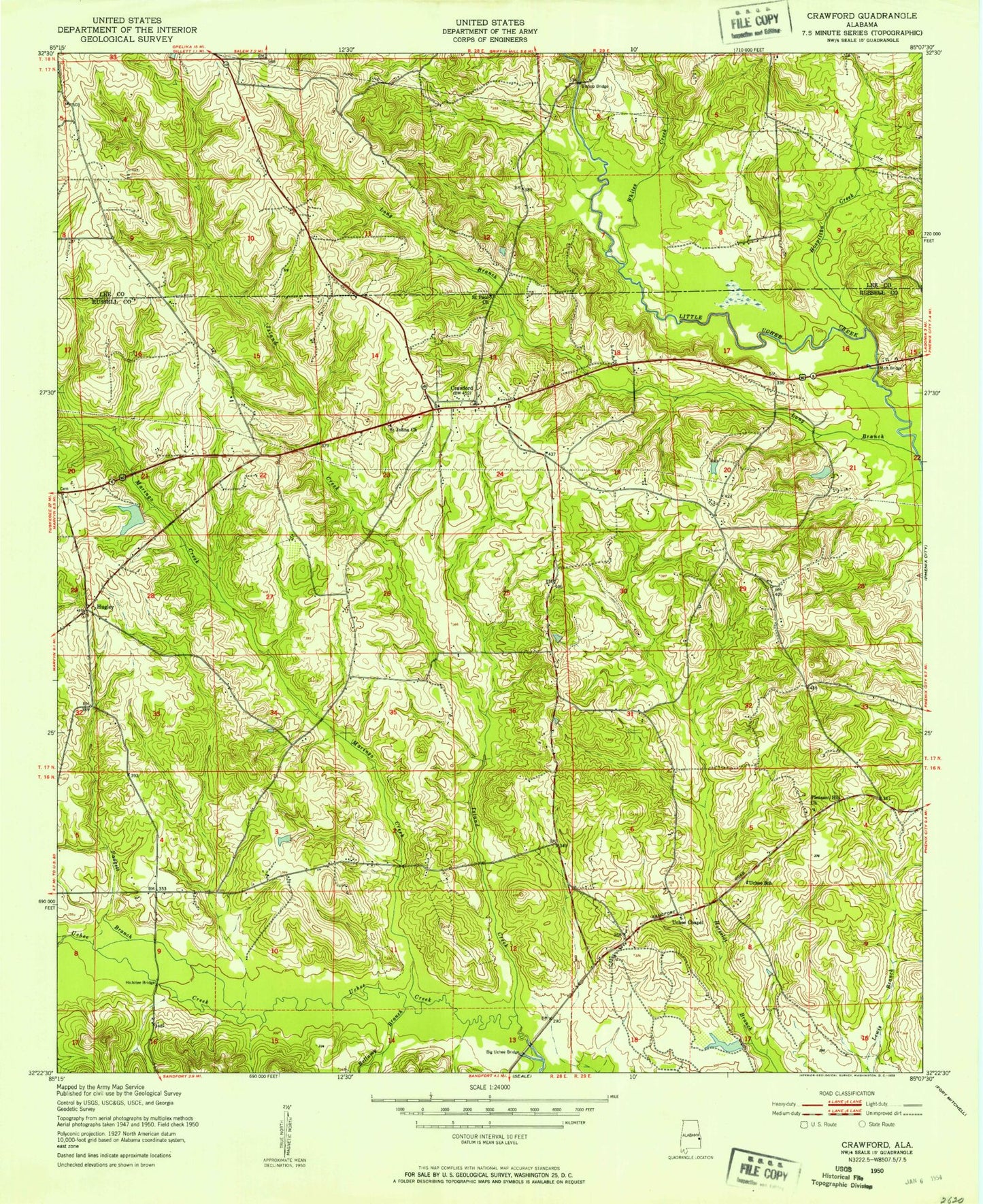
Classic USGS Crawford Alabama 7.5'x7.5' Topo Map
Couldn't load pickup availability
Historical USGS topographic quad map of Crawford in the state of Alabama. Map scale may vary for some years, but is generally around 1:24,000. Print size is approximately 24" x 27"
This quadrangle is in the following counties: Lee, Russell.
The map contains contour lines, roads, rivers, towns, and lakes. Printed on high-quality waterproof paper with UV fade-resistant inks, and shipped rolled.
Contains the following named places: Adams Branch, Bellamy Branch, Bennett Cemetery, Bishops Bridge, Browns Pond, Clarks Lake, Crawford, Crawford Cemetery, Crawford Division, Crawford Road Church, Crawford Volunteer Fire Department, Crouch Pond Dam, Dudley Lake, East Alabama Motor Speedway, Faith Temple, Finkley Farm Airport, Fullers Pond, Goodwill Church, Gullatts Lake, Heath Dam, Heath Lake, Hichitee Bridge, Hospilika Creek, Hugley, Hugleys Pond, Island Creek, Jowers Cemetery, Kites Pond, Little Uchee Bridge, Lydells Pond, Maringo Creek, Moffatt School, Padgett Branch, Parkman Pond Dam, Parkmans Pond, Parkmanville, Parrs Pond, Phillips - Barnett Cemetery, Pleasant Hill Church, Saint Johns Church, Saint Pauls Church, Smiths Pond, Uchee Chapel, Uchee School, Wheeless Pond, Whites Creek, Williams Lake, Williams Lake Dam