MyTopo
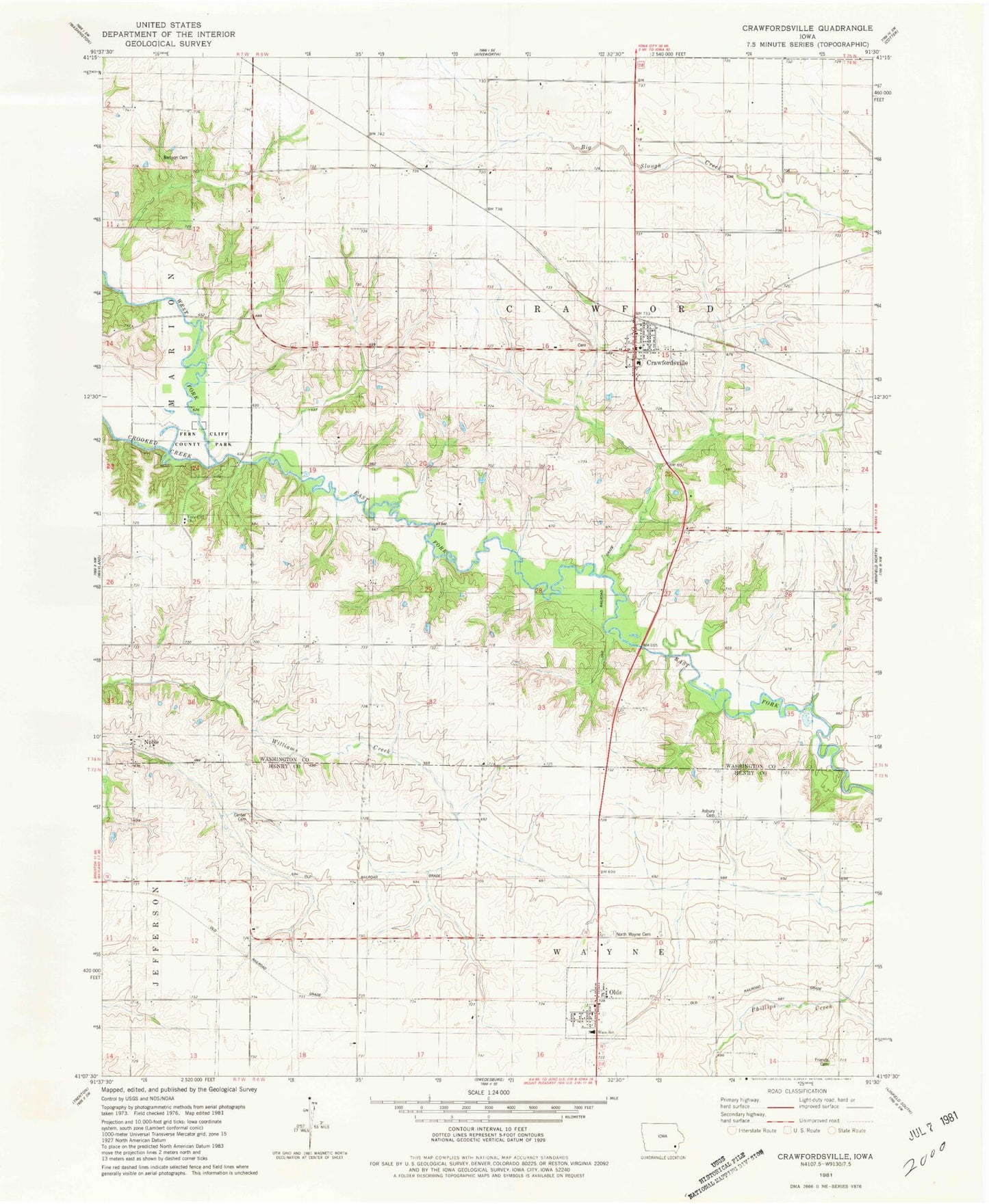
Classic USGS Crawfordsville Iowa 7.5'x7.5' Topo Map
Couldn't load pickup availability
Historical USGS topographic quad map of Crawfordsville in the state of Iowa. Map scale may vary for some years, but is generally around 1:24,000. Print size is approximately 24" x 27"
This quadrangle is in the following counties: Henry, Washington.
The map contains contour lines, roads, rivers, towns, and lakes. Printed on high-quality waterproof paper with UV fade-resistant inks, and shipped rolled.
Contains the following named places: Asbury Cemetery, Benson Cemetery, Center Cemetery, City of Crawfordsville, City of Olds, Crawford Township Benefited Fire District, Crawfordsville, Crawfordsville Cemetery, Crawfordsville City Hall, Crawfordsville Post Office, Crawfordsville United Church, Crawfordsville Water Treatment Plant, Dove Fellowship, East Fork Crooked Creek, Fern Cliff Church, Fern Cliff County Park, Fern Cliff Evangelic Cemetery, Friends Cemetery, Noble, Noble Post Office, North Wayne Cemetery, Old Military Road Historical Marker, Olds, Olds City Hall, Olds Fire Department, Olds Post Office, Olds United Church of Christ, Prairie Ag Co-op Elevator, Rumble Cemetery, Sycamore Mall, Township of Crawford, United Presbyterian Church, Waco Elementary School, Waco School, Wayne, Wayne Post Office, West Fork Crooked Creek, Wyman Grain Company Elevator, ZIP Codes: 52621, 52647