MyTopo
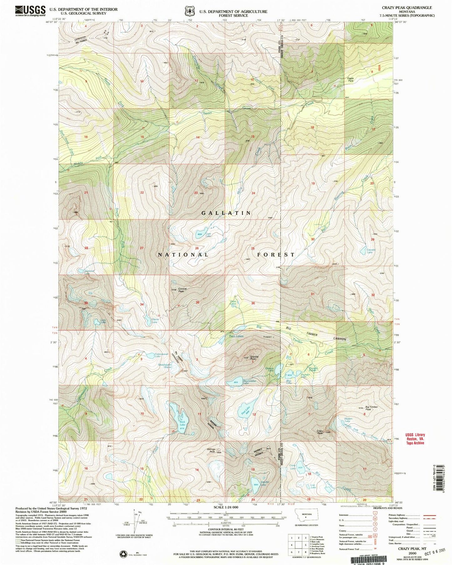
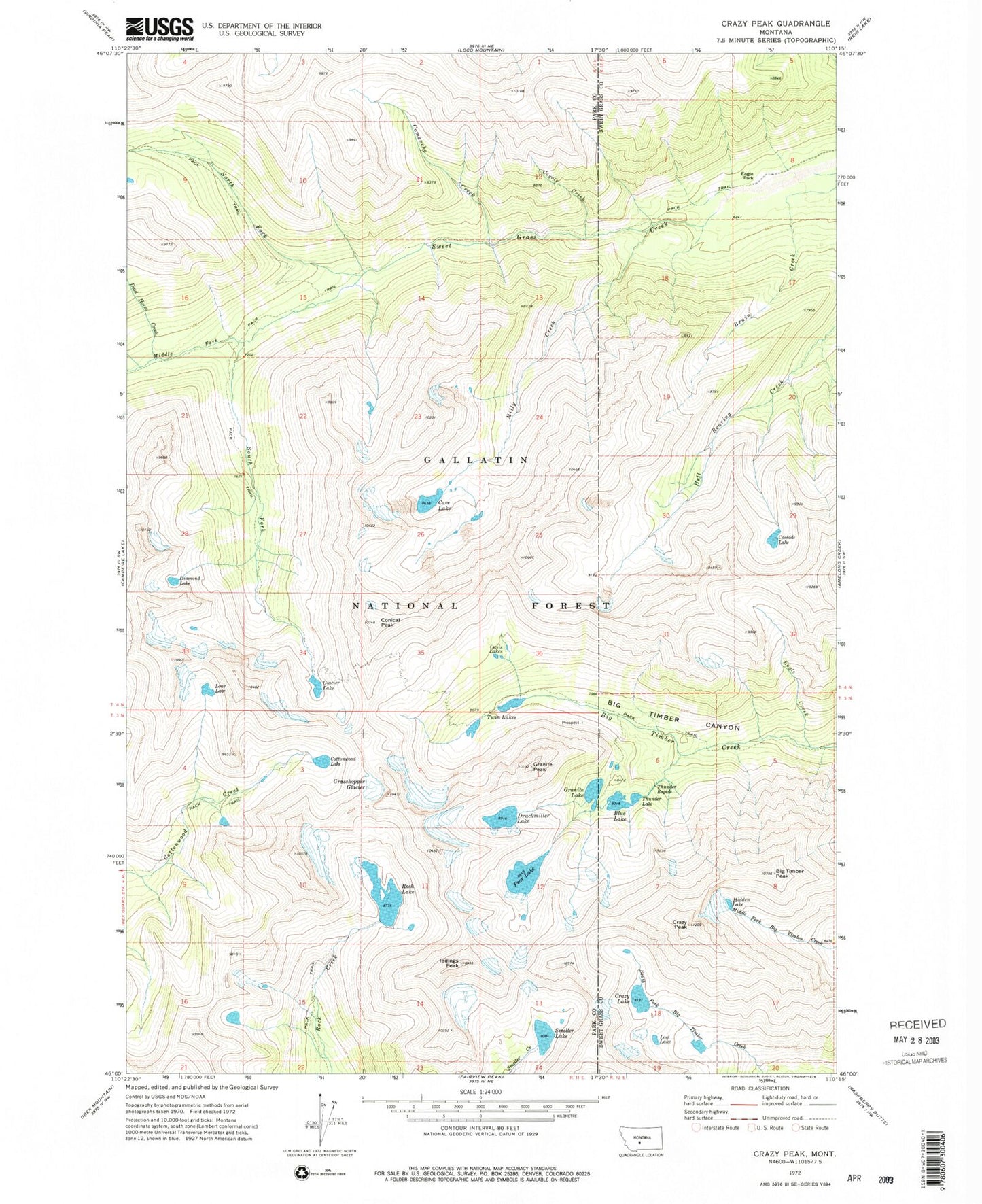
Classic USGS Crazy Peak Montana 7.5'x7.5' Topo Map
Couldn't load pickup availability
Historical USGS topographic quad map of Crazy Peak in the state of Montana. Typical map scale is 1:24,000, but may vary for certain years, if available. Print size: 24" x 27"
This quadrangle is in the following counties: Park, Sweet Grass.
The map contains contour lines, roads, rivers, towns, and lakes. Printed on high-quality waterproof paper with UV fade-resistant inks, and shipped rolled.
Contains the following named places: Big Timber Peak, Blue Lake, Cascade Lake, Cave Lake, Comanche Creek, Conical Peak, Cottonwood Lake, Coyote Creek, Crazy Lake, Crazy Mountains, Crazy Peak, Dead Horse Creek, Diamond Lake, Druckmiller Lake, Eagle Creek, Eagle Park, Glacier Lake, Granite Lake, Granite Peak, Grasshopper Glacier, Hidden Lake, Iddings Peak, Lone Lake, Lost Lake, Middle Fork Sweet Grass Creek, Milly Creek, North Fork Sweet Grass Creek, Oasis Lakes, Pear Lake, Rock Lake, Smeller Lake, South Fork Sweet Grass Creek, Thunder Lake, Thunder Rapids, Twin Lakes, Granite Mountain Mine, Granite Mountain Shaft, Upper Stemwinder Mine, Stemwinder Mine, Wilsall Peak