MyTopo
Classic USGS Crazyman Coulee Montana 7.5'x7.5' Topo Map
Regular price
$16.95
Regular price
Sale price
$16.95
Unit price
per
Couldn't load pickup availability
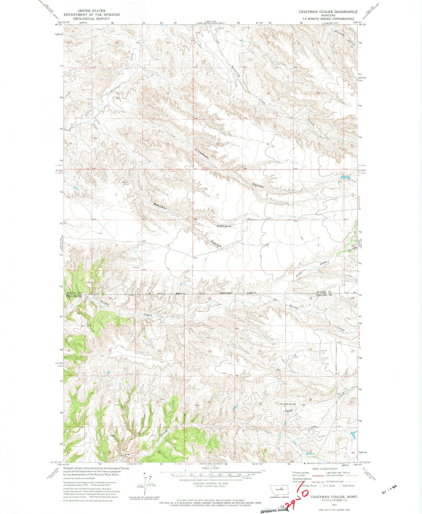
Historical USGS topographic quad map of Crazyman Coulee in the state of Montana. Map scale may vary for some years, but is generally around 1:24,000. Print size is approximately 24" x 27"
This quadrangle is in the following counties: Blaine, Phillips.
The map contains contour lines, roads, rivers, towns, and lakes. Printed on high-quality waterproof paper with UV fade-resistant inks, and shipped rolled.
Contains the following named places: 25N22E12CABA01 Well, 25N22E13DDB_01 Well, 25N23E21CAAC01 Well, 26N23E30DBD_01 Well, Brockie Spring, Crazyman Coulee, Matador Coulee, Nantelle Post Office, Nantelle Spring, Otter Robe Coulee