MyTopo
Classic USGS Creedman Coulee East Montana 7.5'x7.5' Topo Map
Regular price
$16.95
Regular price
Sale price
$16.95
Unit price
per
Couldn't load pickup availability
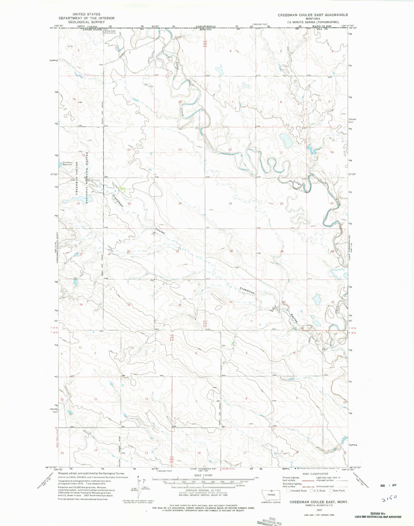
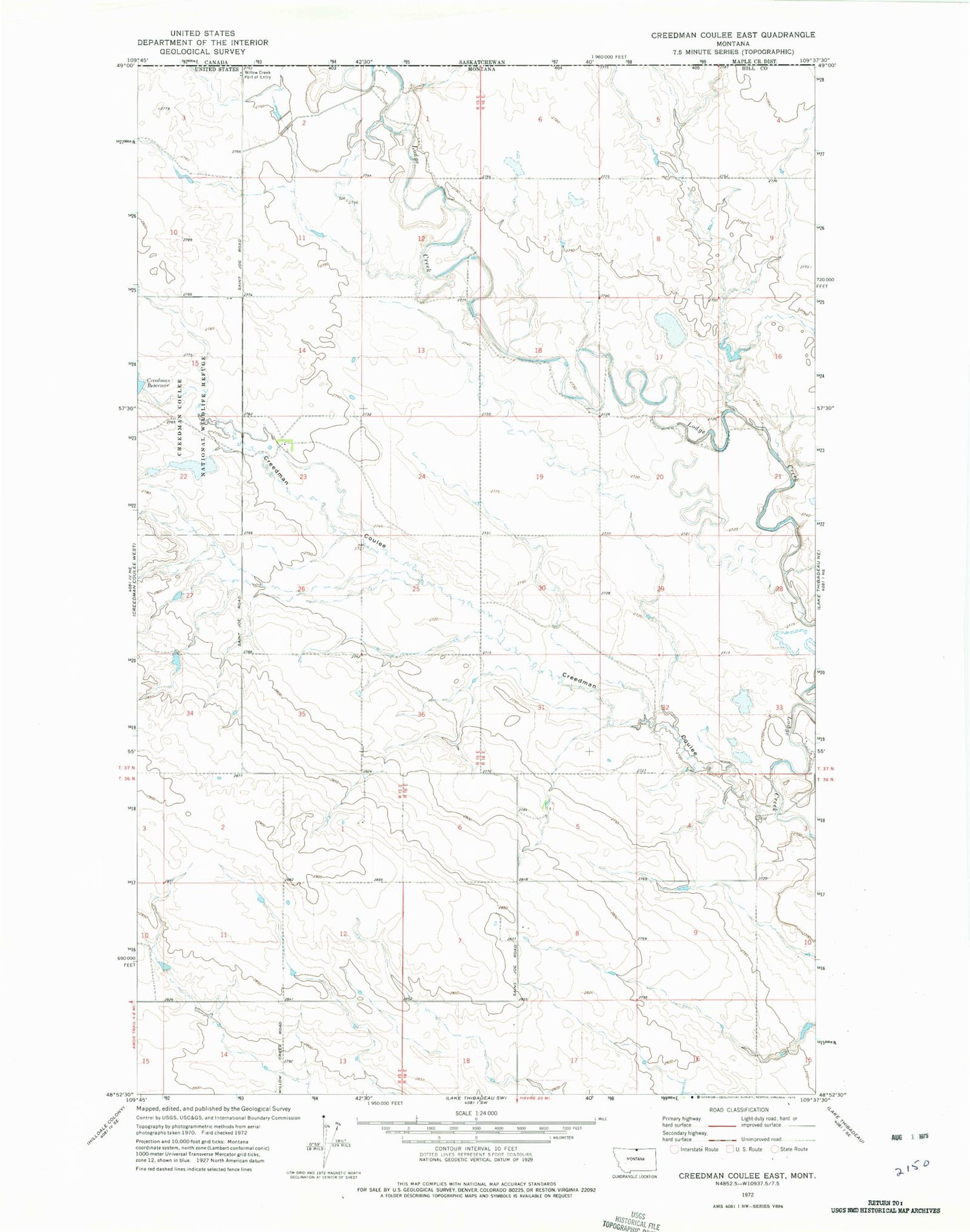
Historical USGS topographic quad map of Creedman Coulee East in the state of Montana. Map scale may vary for some years, but is generally around 1:24,000. Print size is approximately 24" x 27"
This quadrangle is in the following counties: Hill.
The map contains contour lines, roads, rivers, towns, and lakes. Printed on high-quality waterproof paper with UV fade-resistant inks, and shipped rolled.
Contains the following named places: Creedman Coulee, Creedman Reservoir, Edward Enterprises Dam, Hanson Coulee Dam, Kahn Coulee, Schotish Dam, South Fork Greenman Coulee, United States Customs and Border Protection Willow Creek Port of Entry