MyTopo
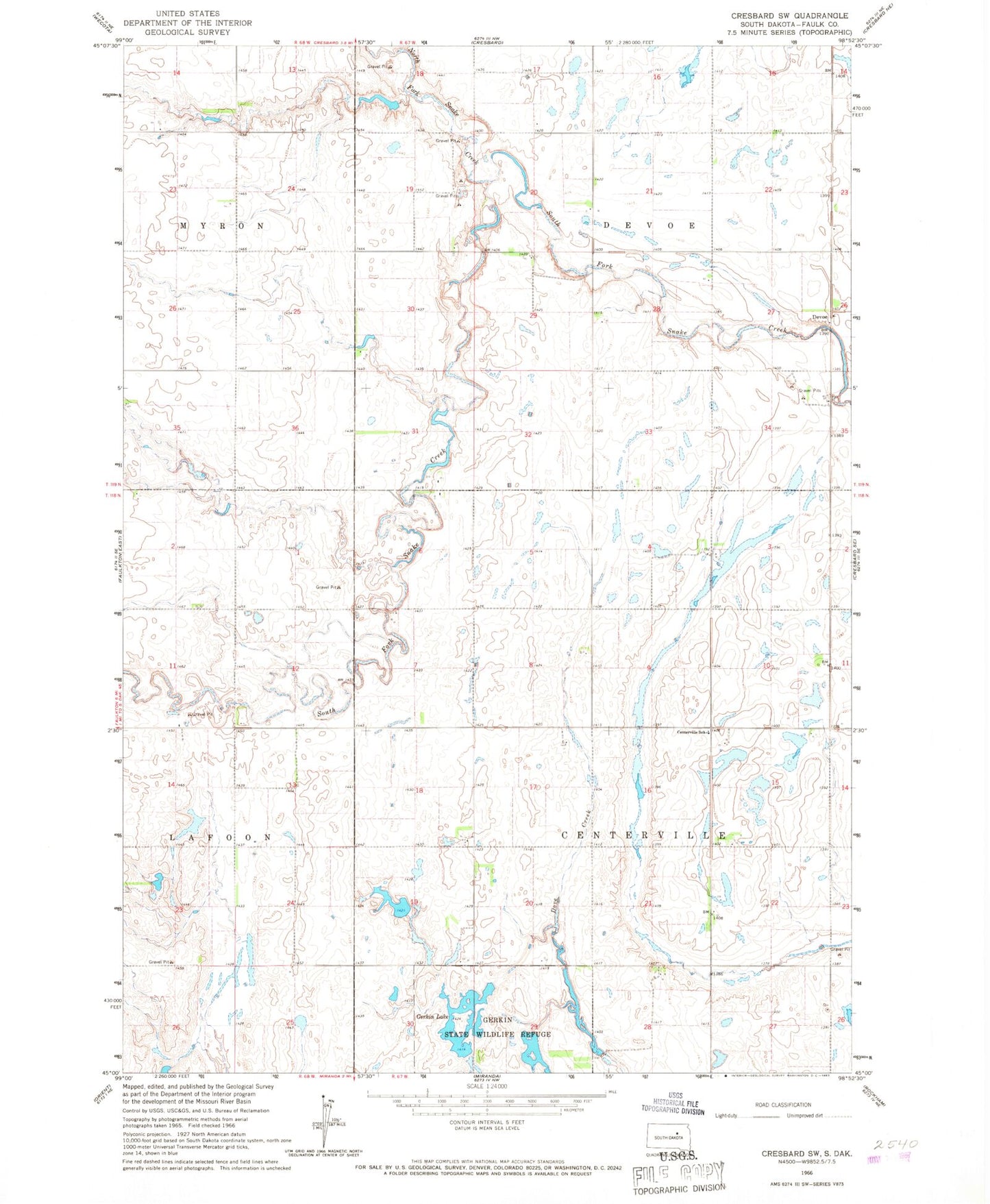
Classic USGS Cresbard SW South Dakota 7.5'x7.5' Topo Map
Couldn't load pickup availability
Historical USGS topographic quad map of Cresbard SW in the state of South Dakota. Map scale may vary for some years, but is generally around 1:24,000. Print size is approximately 24" x 27"
This quadrangle is in the following counties: Faulk.
The map contains contour lines, roads, rivers, towns, and lakes. Printed on high-quality waterproof paper with UV fade-resistant inks, and shipped rolled.
Contains the following named places: Centerville School, Centerville Township Hall, Devoe, DeVoe Community Building, Gerkin Lake, Gerkin Refuge Number 1 Dam, Gerkin Refuge Number 2 Dam, Gerkin Refuge Number 3 Dam, Gerkin State Wildlife Refuge, North Fork Snake Creek, Township of Berea, Township of Centerville, Township of Devoe