MyTopo
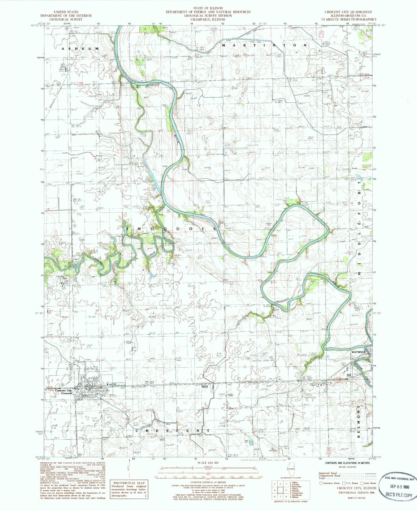
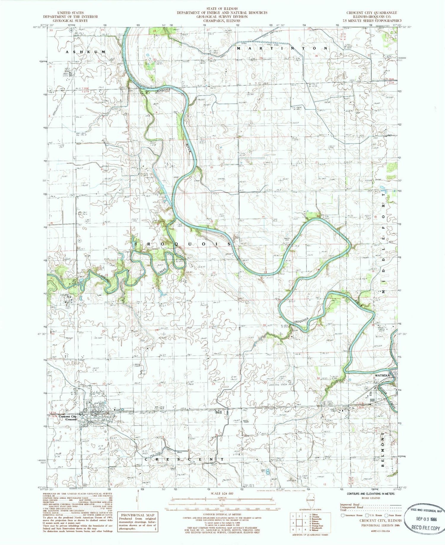
Classic USGS Crescent City Illinois 7.5'x7.5' Topo Map
Couldn't load pickup availability
Historical USGS topographic quad map of Crescent City in the state of Illinois. Map scale may vary for some years, but is generally around 1:24,000. Print size is approximately 24" x 27"
This quadrangle is in the following counties: Iroquois.
The map contains contour lines, roads, rivers, towns, and lakes. Printed on high-quality waterproof paper with UV fade-resistant inks, and shipped rolled.
Contains the following named places: Braden Farms Airport, Cleveland School, Columbia School, Crescent - Iroquois Emergency Medical Services and Ambulance Services, Crescent - Iroquois Fire Protection District, Crescent City, Crescent City Elementary School, Crescent City Post Office, Crescent City Station, Crescent-Iroquois High School, Dietchweiler Airport, Fiddler Bridge, Flesher Cemetery, Hi Ho Farm, Liberty Loan School, Loveridge School, Lyman Cemetery, Lyman School, Pierce Cemetery, Plato Bridge, Plato Post Office, Plato School, Prairie View School, Schoon School, Spring Creek, Sugar Creek, Township of Iroquois, Village of Crescent City, Washington School, Wessels Farms, WGFA-AM (Watseka), WGFA-FM (Watseka), Wilson Cemetery, Yates Farm