MyTopo
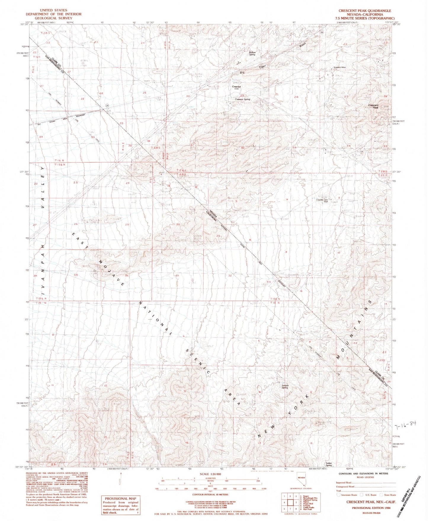
Classic USGS Crescent Peak Nevada 7.5'x7.5' Topo Map
Couldn't load pickup availability
Historical USGS topographic quad map of Crescent Peak in the states of Nevada, California. Map scale may vary for some years, but is generally around 1:24,000. Print size is approximately 24" x 27"
This quadrangle is in the following counties: Clark, San Bernardino.
The map contains contour lines, roads, rivers, towns, and lakes. Printed on high-quality waterproof paper with UV fade-resistant inks, and shipped rolled.
Contains the following named places: Big Tiger Wash, Bullion Spring, Castle Peaks, Crescent, Crescent Mine, Crescent Mining District, Crescent Peak, Crescent Post Office, Crescent Spring, Crippled Jack Well, Crossman Spring, Crossman Well, Golden Calf Mine, Indian Spring, Juniper Spring, Morgan Mine, Nippeno Mill, Nippeno Mine, Nu-Lite Insulated Homes Incorporated Mine, Smithson Phillips Mine, Surveyors Spring, Toltec Mine