MyTopo
Classic USGS Cressey California 7.5'x7.5' Topo Map
Couldn't load pickup availability
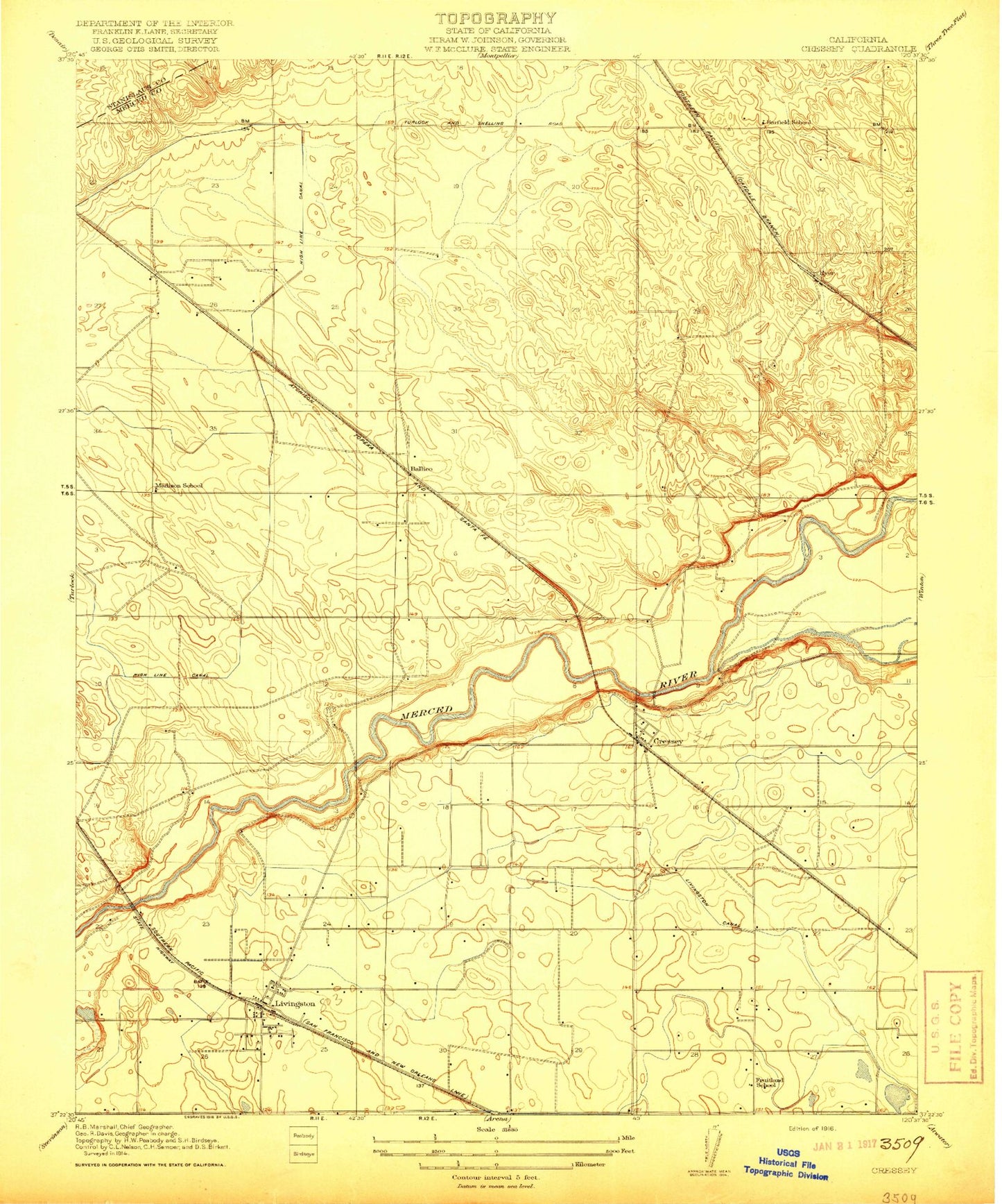
Historical USGS topographic quad map of Cressey in the state of California. Map scale may vary for some years, but is generally around 1:24,000. Print size is approximately 24" x 27"
This quadrangle is in the following counties: Merced, Stanislaus.
The map contains contour lines, roads, rivers, towns, and lakes. Printed on high-quality waterproof paper with UV fade-resistant inks, and shipped rolled.
Contains the following named places: Apostolic Assembly Church, Arakelian Park, Ballico, Ballico Census Designated Place, Ballico Elementary School, Ballico Park, Ballico Post Office, Barfield School, Camp McConnell, Campus Park Elementary School, Church of Christ, City of Livingston, Cortez, Cortez Presbyterian Church, Cressey, Cressey Census Designated Place, Cressey Elementary School, Cressey Lateral, Cressey Post Office, Curtner Lateral, Dry Creek, Fruitland School, Hammatt Lateral, Hunter Lateral, Jones Drain, King Lateral, Leatherman Lateral, Livingston, Livingston Branch Merced County Library, Livingston Canal, Livingston City Hall, Livingston High School, Livingston Intermediate School, Livingston Memorial Park, Livingston Police Department, Livingston Post Office, Livingston-Delhi Division, Madison School, McConnell Livingston Lateral, McConnell State Recreation Area, Merced County Fire Department Ballico Fire Station 92, Merced County Fire Department Cressey Fire Station 64, Merced County Fire Department Livingston Fire Station 96, North Bloom Lateral, Our Redeemer Lutheran Church, Parr Lateral, R V Dairy, Saint Judes Roman Catholic Church, Saint Judes School, Selma Herndon Elementary School, Silva Drain, South Bloom Lateral, Sproul Lateral, Stoddard Lateral, Turlock Municipal Airport, Veldhuis North Dairy, Veterans Memorial Building, Wakefield Lateral, Watson Lateral, Winton Cemetery, ZIP Codes: 95303, 95312


