MyTopo
Classic USGS Creswell SE North Carolina 7.5'x7.5' Topo Map
Regular price
$16.95
Regular price
Sale price
$16.95
Unit price
per
Couldn't load pickup availability
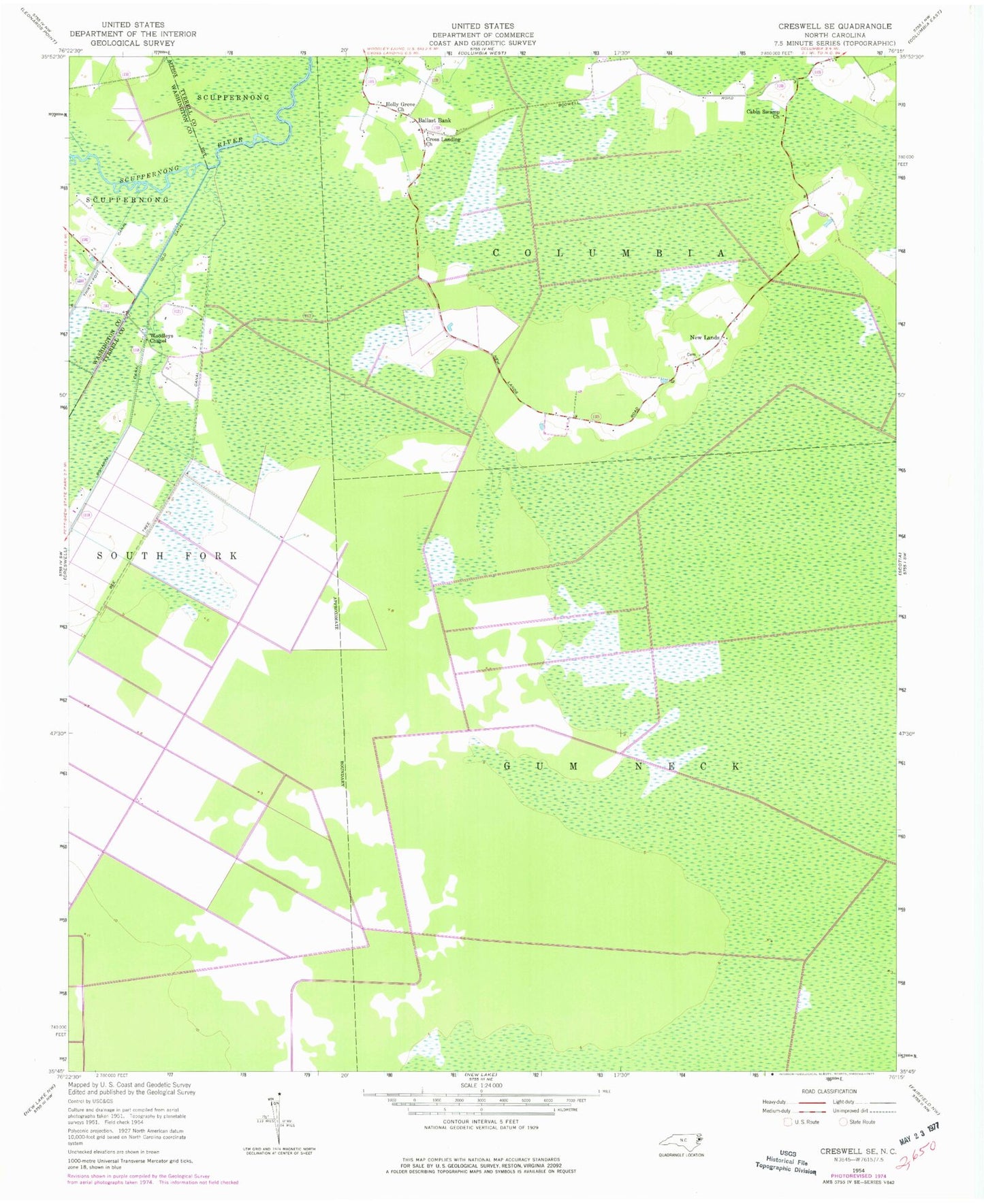
Historical USGS topographic quad map of Creswell SE in the state of North Carolina. Map scale may vary for some years, but is generally around 1:24,000. Print size is approximately 24" x 27"
This quadrangle is in the following counties: Tyrrell, Washington.
The map contains contour lines, roads, rivers, towns, and lakes. Printed on high-quality waterproof paper with UV fade-resistant inks, and shipped rolled.
Contains the following named places: Ballast Bank, Bee Tree Canal, Cabin Swamp Church, Cross Landing Church, Holly Grove Church, New Lands, Old Canal, Township of South Fork, Woodleys Chapel