
MyTopo
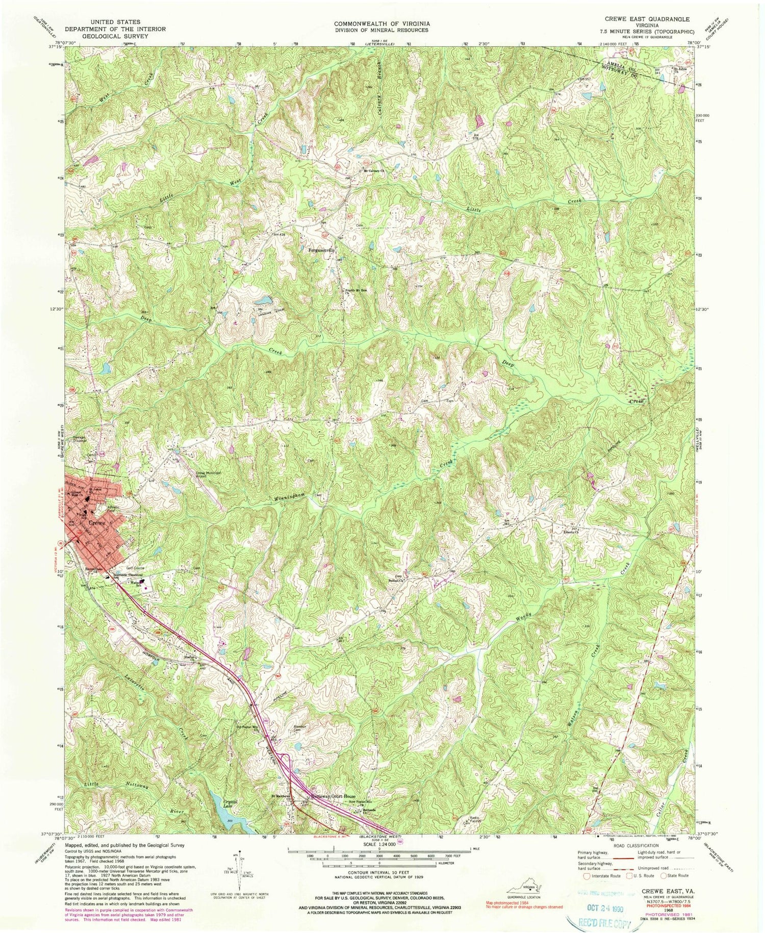
Classic USGS Crewe East Virginia 7.5'x7.5' Topo Map
Couldn't load pickup availability
Historical USGS topographic quad map of Crewe East in the state of Virginia. Map scale may vary for some years, but is generally around 1:24,000. Print size is approximately 24" x 27"
This quadrangle is in the following counties: Amelia, Nottoway.
The map contains contour lines, roads, rivers, towns, and lakes. Printed on high-quality waterproof paper with UV fade-resistant inks, and shipped rolled.
Contains the following named places: Arnolds Dam, Austins Dam, Belfast Church, Bethesda Church, Blendon Cemetery, Crewe, Crewe Baptist Church, Crewe Christian Church, Crewe High School, Crewe Municipal Airport, Crewe Police Department, Crewe Post Office, Crewe Primary School, Crewe United Methodist Church, Crystal Lake, District 2, District 3, Eleven Oaks Church, Fergusonville, Fourth Mount Zion Church, Freeman Cemetery, Gibson Memorial Church, Hendersonville, Hendersonville School, Lazaretto Creek, Liberty Church, Little West Creek, Lunsalord Cemetery, Mount Calvary Church, New Poplar Mountain Church, Nottoway County, Nottoway County Emergency Squad, Nottoway County Sheriff's Office, Nottoway Court House, Nottoway Court House Census Designated Place, Nottoway Post Office, Old Poplar Mountain Church, Pryor Memorial Presbyterian Church, Robinson Cemetery, Saint Johns Church, Saint Matthews Church, Sharon Church, Sheltons Dam, Southside Skill Center, Strum Cemetery, Towler Cemetery, Watson Creek, Watson Elementary School, Winningham Creek, ZIP Code: 23930


