MyTopo
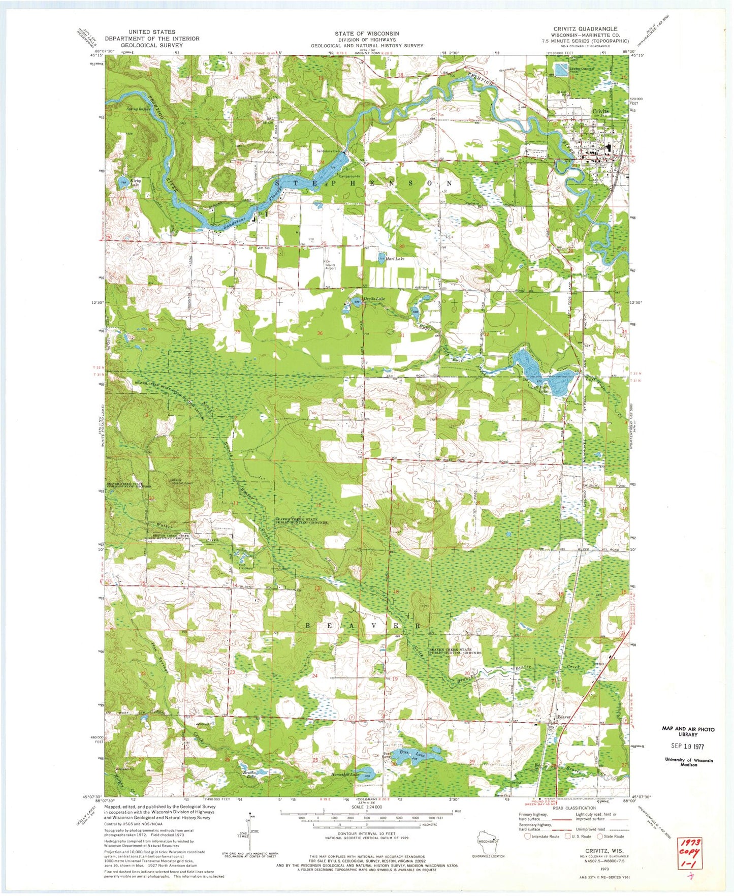
Classic USGS Crivitz Wisconsin 7.5'x7.5' Topo Map
Couldn't load pickup availability
Historical USGS topographic quad map of Crivitz in the state of Wisconsin. Map scale may vary for some years, but is generally around 1:24,000. Print size is approximately 24" x 27"
This quadrangle is in the following counties: Marinette.
The map contains contour lines, roads, rivers, towns, and lakes. Printed on high-quality waterproof paper with UV fade-resistant inks, and shipped rolled.
Contains the following named places: Bass Lake, Beaver, Beaver Church, Beaver Creek State Public Hunting Grounds, Beaver Lookout Tower, Brooks Lake, Crivitz, Crivitz Elementary and Middle School, Crivitz High School, Crivitz Municipal Airport, Crivitz Police Department, Crivitz Post Office, Crivitz Rescue Squad, Crivitz Volunteer Fire Department, Devils Lake, Flower Nook School, Horseshoe Lake, Iron Springs Creek, Kirby Hill School, Kirby Lake, Left Foot Lake, Mar - Oco Sanitary Landfill, Marl Lake, Oak Ridge School, Sandstone Dam, Sandstone Flowage, Sandstone Rapids WP214 Dam, Sandstone Reservoir 675, Spring Rapids, Town of Beaver, Village of Crivitz, Walker Creek, Weber School, Woodrow Wilson School, ZIP Code: 54114