MyTopo
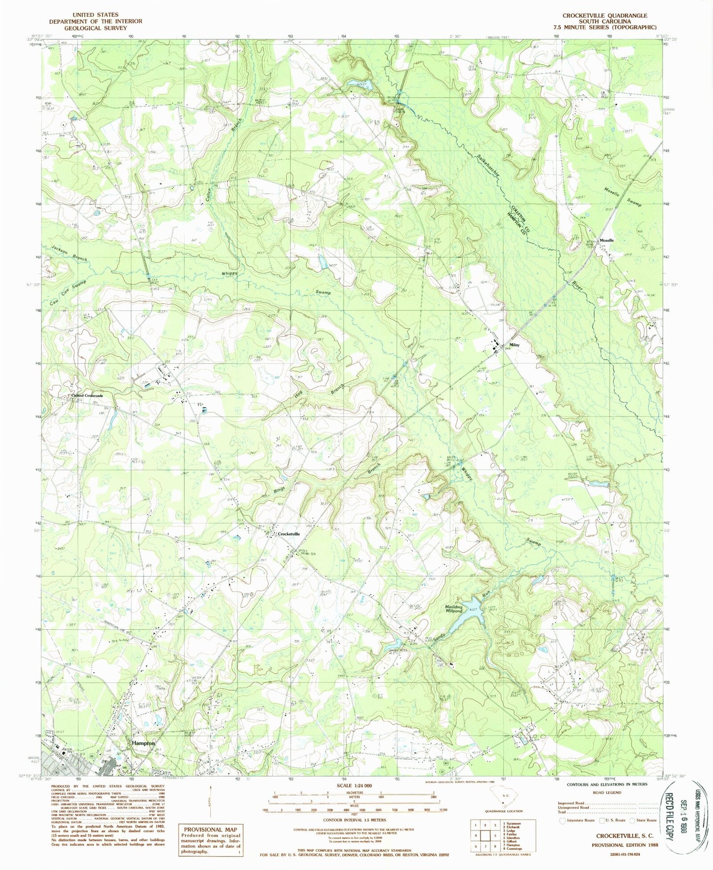
Classic USGS Crocketville South Carolina 7.5'x7.5' Topo Map
Couldn't load pickup availability
Historical USGS topographic quad map of Crocketville in the state of South Carolina. Map scale may vary for some years, but is generally around 1:24,000. Print size is approximately 24" x 27"
This quadrangle is in the following counties: Colleton, Hampton.
The map contains contour lines, roads, rivers, towns, and lakes. Printed on high-quality waterproof paper with UV fade-resistant inks, and shipped rolled.
Contains the following named places: Ben Hazel Primary School, Bethlehem Church, Bings Branch, Broxton Bridge, Calico Branch, Caw Caw Swamp, Cedar Grove School, Cleland Crossroads, Cleland School, Crocketville, Crocketville Post Office, Dry Swamp School, Enon Church, God of Prophesy Church, Gooding Cemetery, Grace Baptist Church, Hampton Industrial Park, Harmony Church, Hay School, Hickory Grove Church, Hickory Grove School, Hog Branch, Jackson Branch, Jenny and Platts Sawmill, Kinards Pond, Lone Star School, Maulding Millpond, Miley, Miley Church of God, Miley Post Office, Moselle, Mount Pleasant Church, New Hope School, Platts School, Poor Hope Church, Saint Paul Church, Saint Paul School, Sanders Branch School, Sandy Branch Church, Sandy Run, Sandy Run Baptist Church, Sandy Run School, Shady Grove Church, Sinai Church, Sky City Plaza Shopping Center, South Carolina Noname 25016 D-2597 Dam, West End Shopping Center, Wymans School, ZIP Code: 29924