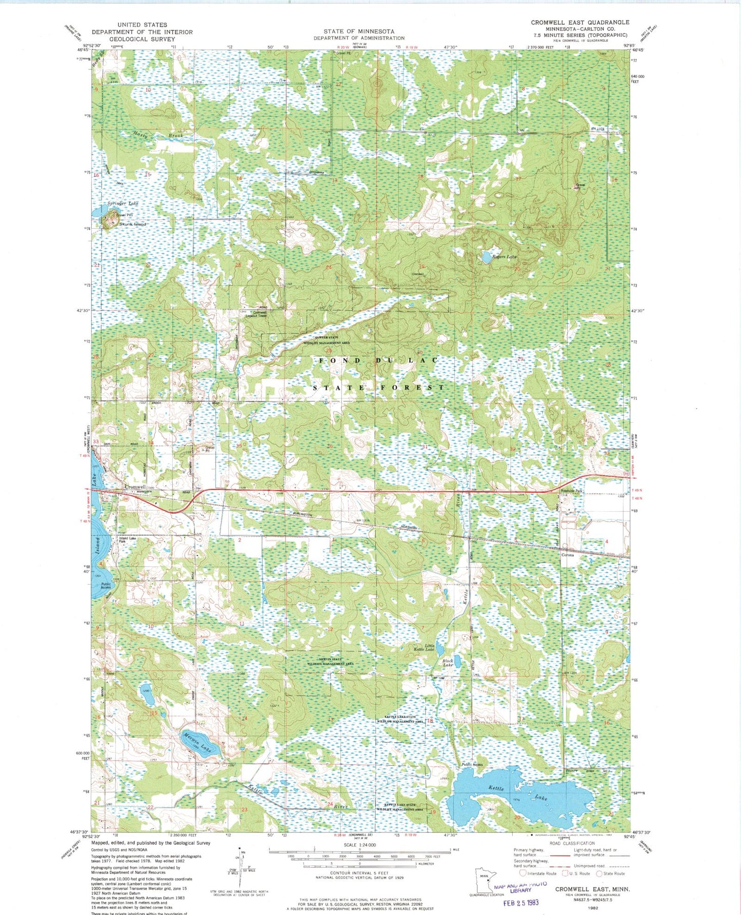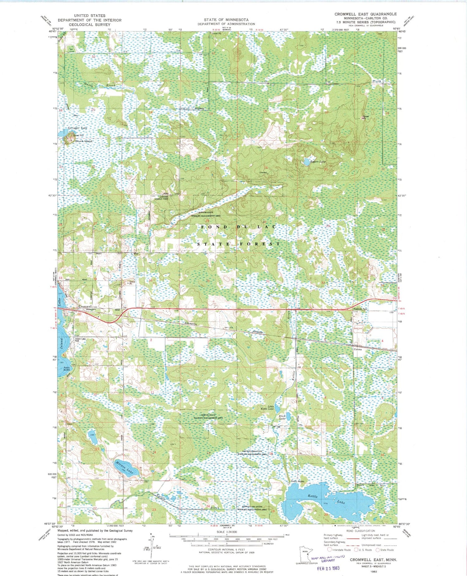
MyTopo
Classic USGS Cromwell East Minnesota 7.5'x7.5' Topo Map
Couldn't load pickup availability
Historical USGS topographic quad map of Cromwell East in the state of Minnesota. Map scale may vary for some years, but is generally around 1:24,000. Print size is approximately 24" x 27"
This quadrangle is in the following counties: Carlton.
The map contains contour lines, roads, rivers, towns, and lakes. Printed on high-quality waterproof paper with UV fade-resistant inks, and shipped rolled.
Contains the following named places: Black Lake, City of Cromwell, Corona, Corona Post Office, County Ditch Number Two, Cromwell Lookout Tower, Fond du Lac State Forest, Island Lake Campgrounds, Island Lake Park, Kettle Lake, Kettle Lake State Wildlife Management Area, Little Kettle Lake, Mervin State Wildlife Management Area, Merwin Lake, Rogers Lake, Sawyer State Wildlife Management Area, Skunk Island, Springer Lake, Township of Eagle, Unorganized Territory of North Carlton, ZIP Code: 55726