MyTopo
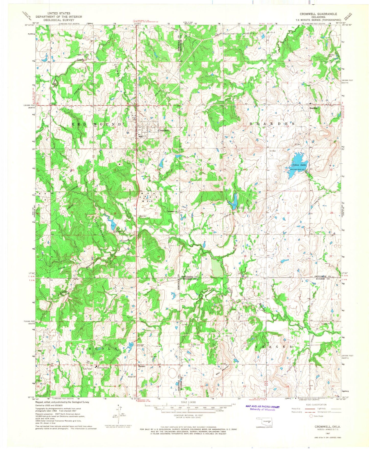
Classic USGS Cromwell Oklahoma 7.5'x7.5' Topo Map
Couldn't load pickup availability
Historical USGS topographic quad map of Cromwell in the state of Oklahoma. Map scale may vary for some years, but is generally around 1:24,000. Print size is approximately 24" x 27"
This quadrangle is in the following counties: Hughes, Okfuskee, Seminole.
The map contains contour lines, roads, rivers, towns, and lakes. Printed on high-quality waterproof paper with UV fade-resistant inks, and shipped rolled.
Contains the following named places: Bald Mountain, Bearden, Bearden Cemetery, Bearden Elementary School, Bearden Fire Department, Butner, Butner Cemetery, Butner Church, Butner Elementary School, Butner High School, Cohee Lake, Cohee Lake Dam, Creek/Seminole Joint-Use Oklahoma Tribal Statistical Area, Cromwell, Cromwell Oil Field, Cromwell Post Office, Cromwell Volunteer Fire Department, Little Quarsarty Cemetery, Little Wewoka Creek Site 5 Dam, Little Wewoka Creek Site 5 Reservoir, Little Wewoka Creek Site 6 Dam, Little Wewoka Creek Site 6 Reservoir, Little Wewoka Site 1 Dam, Little Wewoka Site 1 Reservoir, Little Wewoka Site 4 Dam, Little Wewoka Site 4 Reservoir, Oknoname 037031 Dam, Oknoname 037031 Reservoir, Oknoname 037051 Dam, Oknoname 037051 Reservoir, Quarsarty Church, South Cromwell Oil Field, Town of Bearden, Town of Cromwell, ZIP Code: 74837