MyTopo
Classic USGS Cross Hill South Carolina 7.5'x7.5' Topo Map
Couldn't load pickup availability
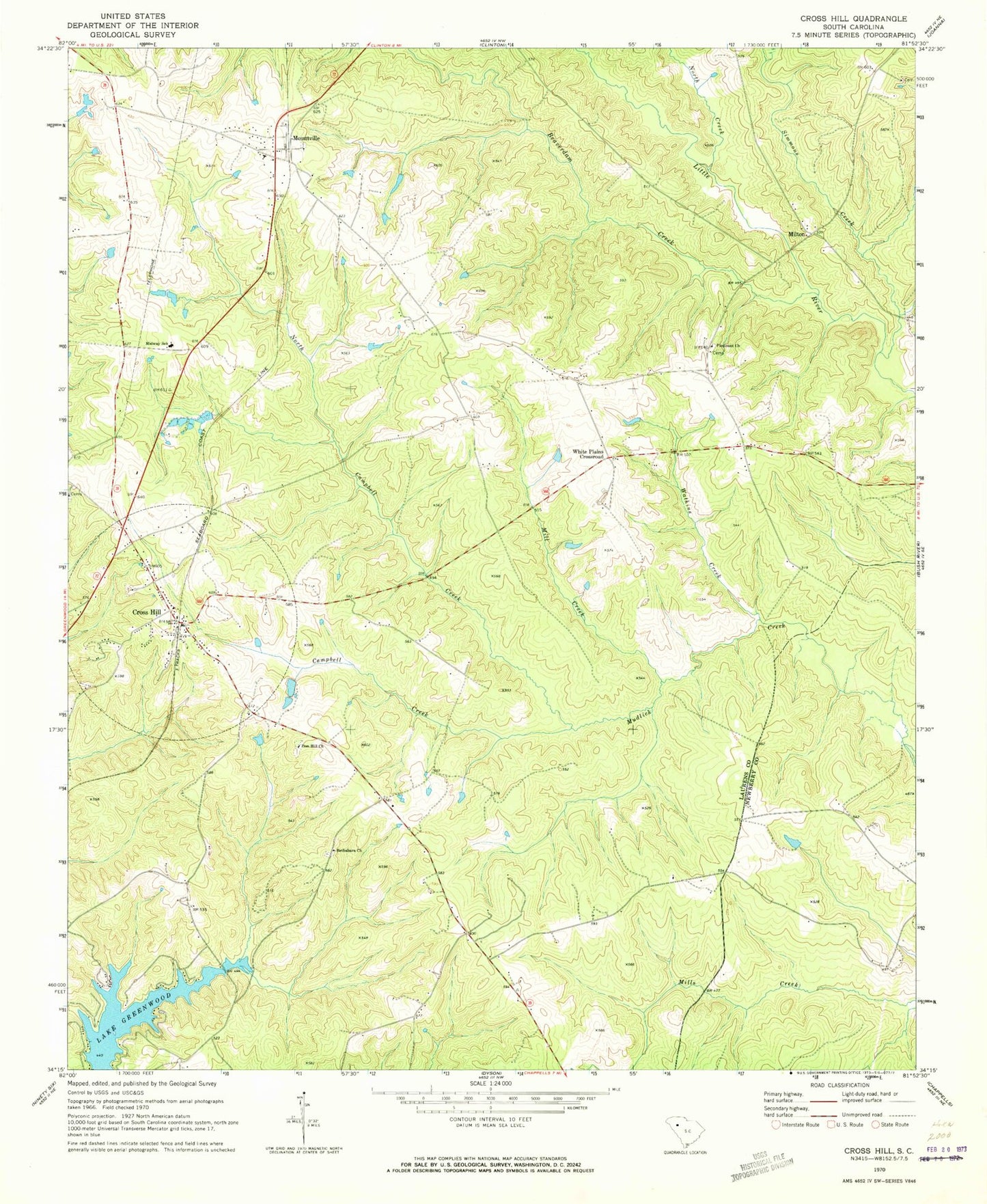
Historical USGS topographic quad map of Cross Hill in the state of South Carolina. Map scale may vary for some years, but is generally around 1:24,000. Print size is approximately 24" x 27"
This quadrangle is in the following counties: Laurens, Newberry.
The map contains contour lines, roads, rivers, towns, and lakes. Printed on high-quality waterproof paper with UV fade-resistant inks, and shipped rolled.
Contains the following named places: Beaverdam Creek, Bethabara Cemetery, Bethabara Church, Black Gate, Black Mill, Campbell Creek, Coggins School, Cross Hill, Cross Hill Baptist Church, Cross Hill Cemetery, Cross Hill Community Fire Department Cross Hill Station 1, Cross Hill Division, Cross Hill Police Department, First Baptist Church, Greenwood, Head Springs Associate Reformed Pres Church, Head Springs Cemetery, Hollingsworth Pond Dam D-2995, Hollingworths Pond, Laurens County Emergency Medical Services Station 4, Laurens County Fire Department Cross Hill Station 2, Laurens County Fire Department Mountville, Liberty Springs Presbyterian Church, Midway School, Mill Creek, Milton, Mount Pleasant Church, Mount Presbyterian Church, Mountville, Mountville Baptist Church, Mountville Census Designated Place, North Campbell Creek, North Creek, Piedmont Church, Piedmont School, Simmons Creek, Spring Grove, Thomason Airfield, Town of Cross Hill, Watkins Creek, White Plains Crossroad, Zion Hill Church, ZIP Codes: 29332, 29370