MyTopo
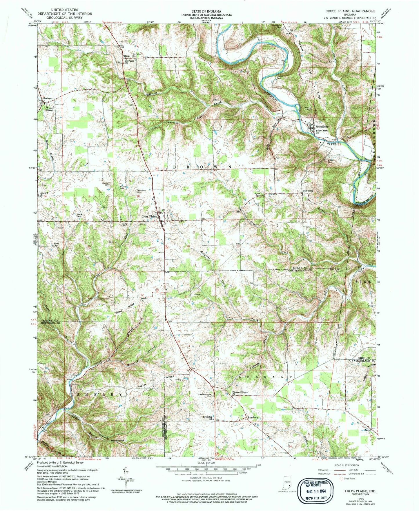
Classic USGS Cross Plains Indiana 7.5'x7.5' Topo Map
Couldn't load pickup availability
Historical USGS topographic quad map of Cross Plains in the state of Indiana. Map scale may vary for some years, but is generally around 1:24,000. Print size is approximately 24" x 27"
This quadrangle is in the following counties: Dearborn, Jefferson, Ohio, Ripley, Switzerland.
The map contains contour lines, roads, rivers, towns, and lakes. Printed on high-quality waterproof paper with UV fade-resistant inks, and shipped rolled.
Contains the following named places: Aaron, Akers and Friendship Cemetery, Arlington Avenue Baptist Church, Avonburg, Basset Cemetery, Bear Creek Cemetery, Bear Creek Church, Beebe Cemetery, Black Branch, Black Creek, Caesar Creek, Concord Church, Connell Cemetery, Cross Plains, Cross Plains Post Office, Devils Backbone, Dewberry, Friendship, Friendship Post Office, Friendship Volunteer Fire Department, Horton Hollow, Little Creek, Little Raccoon Creek, McCurry Branch, Miller Branch, Mosquito Creek, Myers Cemetery, Nicholson Cemetery, Olean, Pleasant Grove Cemetery, Pleasant Grove Church, Poplar Ridge, Possum Trot Ridge, Raccoon Creek, Rost Run, Saint Pauls Church, Saint Pauls Church Cemetery, Saint Peters Cemetery, Saint Peters Evangelical Lutheran Cemetery, Salem Branch, Salem Church, Salem Ridge, Township of Brown, Uhlman Creek, Wesley Chapel, Wilson Cemetery, Winkler Cemetery, Young Cemetery, ZIP Codes: 47017, 47224