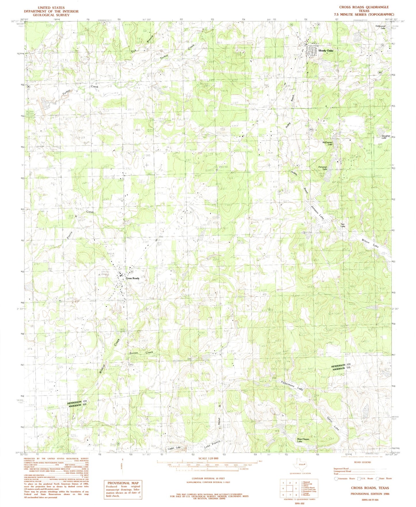
MyTopo
Classic USGS Cross Roads Texas 7.5'x7.5' Topo Map
Couldn't load pickup availability
Historical USGS topographic quad map of Cross Roads in the state of Texas. Typical map scale is 1:24,000, but may vary for certain years, if available. Print size: 24" x 27"
This quadrangle is in the following counties: Anderson, Henderson.
The map contains contour lines, roads, rivers, towns, and lakes. Printed on high-quality waterproof paper with UV fade-resistant inks, and shipped rolled.
Contains the following named places: Anding Branch, Wilson Lake, Barron Creek, Beck Chapel, Cross Roads, Cross Roads School, Patterson Cemetery, Post Oak Cemetery, Corinth Church, Tick Branch, Union Cemetery, Willow Springs Cemetery, Willow Springs Church, Cayuga Oil Field, Ranch House Lake Dam, Ranch House Lake, Gator Lake Dam, Gator Lake, Lake Francis Dam, Lake Francis, Perryman Lake Dam, Jonsson Lake Dam, Tarr Pond Dam, Soil Conservation Service Site 2 Dam, Nichols Lake Dam, Nichols Lake, Kline Lake Dam, Kline Lake, White Lake Dam, White Lake, Triple S Ranch Lake Dam, Bass Haven Lake Dam, Bass Haven Lake, Catfish Lake Dam, Catfish Lake, Shady Oaks, Slaughter Lake, Perryman Lake, Jonnson Lake, Tarr Lake, McElvaney Lake, Cross Roads Elementary School, Deer Meadow Ranch Airport