MyTopo
Classic USGS Cross South Carolina 7.5'x7.5' Topo Map
Couldn't load pickup availability
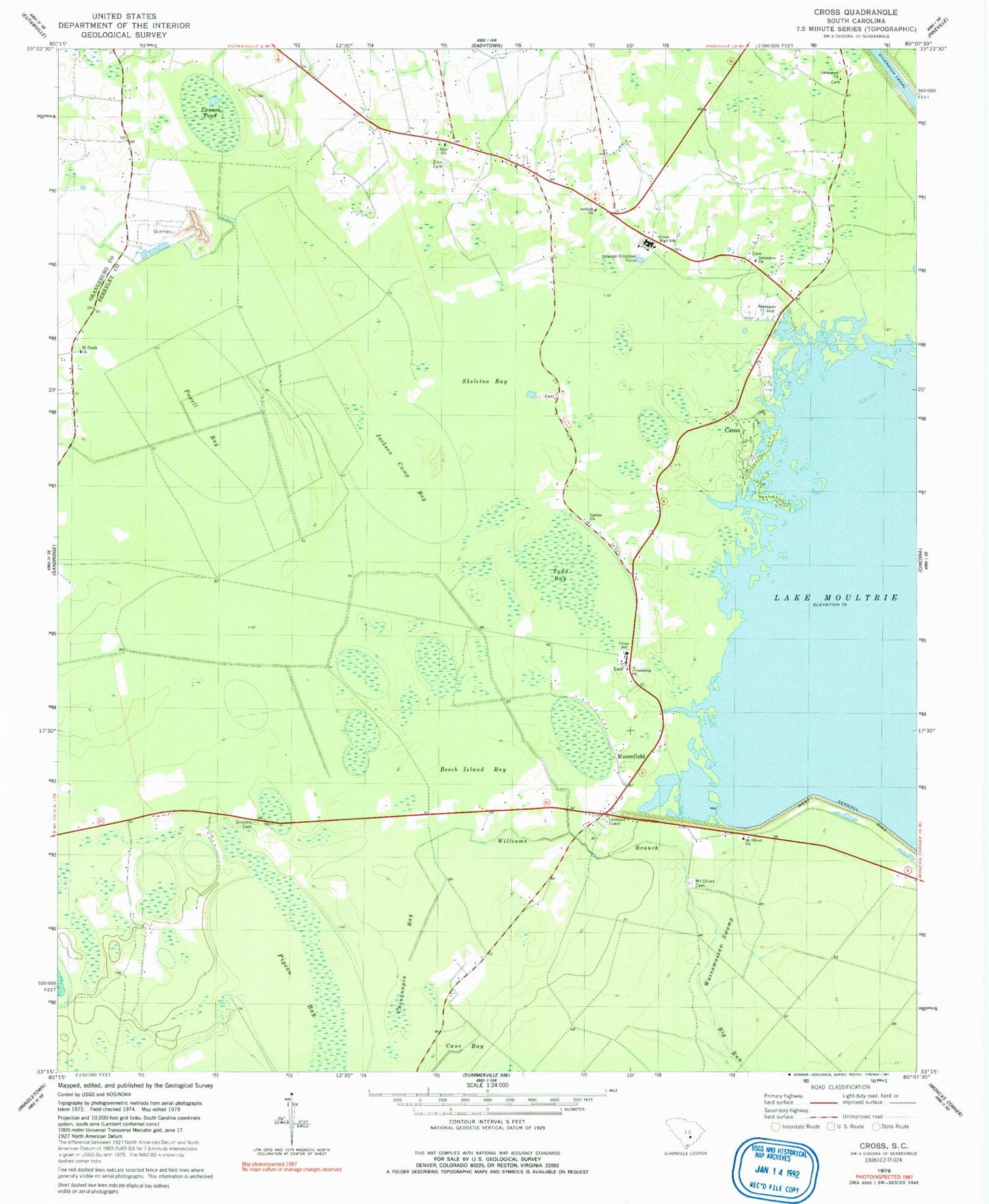
Historical USGS topographic quad map of Cross in the state of South Carolina. Map scale may vary for some years, but is generally around 1:24,000. Print size is approximately 24" x 27"
This quadrangle is in the following counties: Berkeley, Orangeburg.
The map contains contour lines, roads, rivers, towns, and lakes. Printed on high-quality waterproof paper with UV fade-resistant inks, and shipped rolled.
Contains the following named places: Antioch Church, Beech Island Bay, Berkeley Quarry, Black Creek Church, Buzzard Bay, Calamus Pond School, Cane Bay, Chinquapin Bay, Cross, Cross Cross Roads, Cross Division, Cross Elementary School, Cross Fire Department Station 1, Cross Fire Department Station 2, Cross High School, Cross Lookout Tower, Cross Post Office, Cross School, Friendship Cemetery, Friendship Church, Galilee Church, Grooms Cemetery, Immanuel Church, Jackson Camp Bay, Jehovah Church, Jerusalem Church, Lawson Pond, Layton Ridge, Legare, Legare Church, Legare School, Lesesne Airport, Moorefield, Moss Grove, Moss Grove Christian Church, Mount Olivet Baptist Church, Mount Olivet Cemetery, Mudville, Negro Bay, Nelson Hill, Pigeon Bay, Plantation Church, Powell Bay, Prioleau, Saint Pauls Church, Stutch School, Todd Bay, Ward Swamp, Wassamassaw Swamp, White Swamp School, Williams Branch, Zion Cemetery, Zion Church, Zion School, ZIP Code: 29436