MyTopo
Classic USGS Crossman Peak Arizona 7.5'x7.5' Topo Map
Regular price
$16.95
Regular price
Sale price
$16.95
Unit price
per
Couldn't load pickup availability
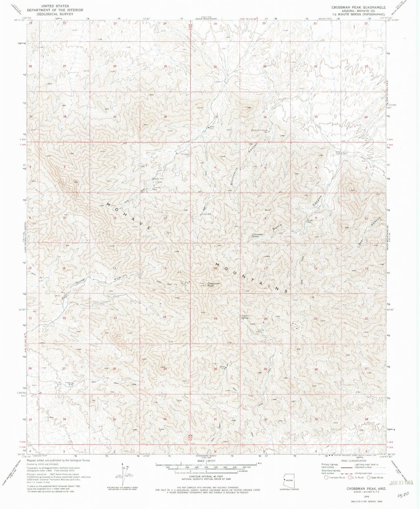
Historical USGS topographic quad map of Crossman Peak in the state of Arizona. Typical map scale is 1:24,000, but may vary for certain years, if available. Print size: 24" x 27"
This quadrangle is in the following counties: Mohave.
The map contains contour lines, roads, rivers, towns, and lakes. Printed on high-quality waterproof paper with UV fade-resistant inks, and shipped rolled.
Contains the following named places: Arrastra Well, Blacksmith Canyon, Blacksmith Canyon Well, Burro Canyon, Burro Well, Cottonwood Spring, Crossman Peak, Jupiter Mine, Jupiter Spring, Pittsburg Mine, Scotts Well, Sunrise Mine, Burro and Cottonwood Well, Scotts Well, KZUL-FM (Lake Havasu City)