MyTopo
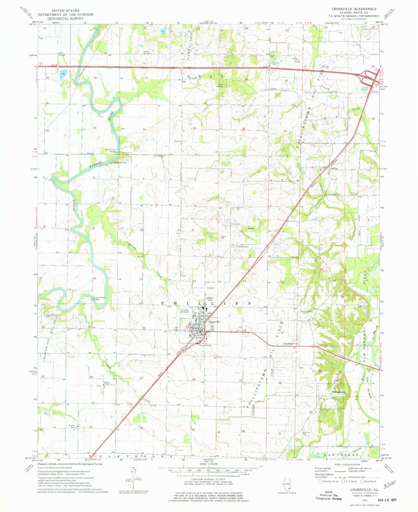
Classic USGS Crossville Illinois 7.5'x7.5' Topo Map
Couldn't load pickup availability
Historical USGS topographic quad map of Crossville in the state of Illinois. Map scale may vary for some years, but is generally around 1:24,000. Print size is approximately 24" x 27"
This quadrangle is in the following counties: White.
The map contains contour lines, roads, rivers, towns, and lakes. Printed on high-quality waterproof paper with UV fade-resistant inks, and shipped rolled.
Contains the following named places: Bell School, Bethel Cemetery, Bethel Church, Blackledge School, Brown Cemetery, Brush School, Bryant Valley Church, Bumblebee Bend School, Calvin, Calvin Cemetery, Charles School, Cherry Cemetery, Cherry Shoals Bridge, Crooked Creek, Crossville, Crossville Elementary School, Crossville Police Department, Crossville Post Office, Crossville Volunteer Fire Department, Elliott Creek, Fairview School, French School, Goodman School, Graves School, Hanks Ferry Bridge, Harper, Hughes School, Little Wabash Church, New Harmony Oil Field, Oakland School, Phillipstown, Phillipstown Oil Field, Riverside Cemetery, Riverside School, Salem Church, Shortville School, Stokes Chapel, Sumpter East Oil Field, Township of Gray, Township of Phillips, Union Cemetery, Union Church, Village of Crossville, Village of Phillipstown, Whiting Family Cemetery, Whitsett School, ZIP Code: 62827