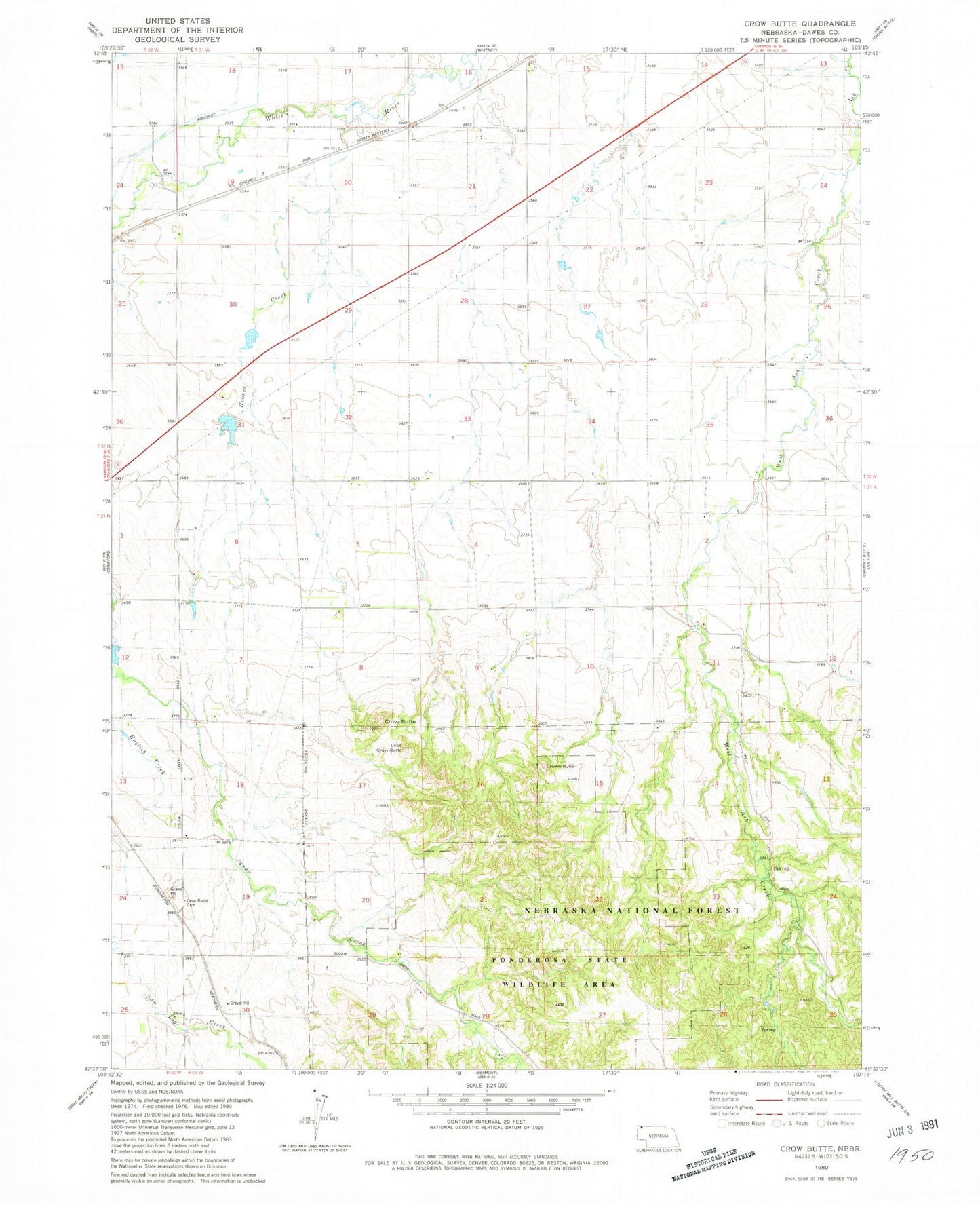
MyTopo
Classic USGS Crow Butte Nebraska 7.5'x7.5' Topo Map
Regular price
$16.95
Regular price
Sale price
$16.95
Unit price
per
Couldn't load pickup availability
Historical USGS topographic quad map of Crow Butte in the state of Nebraska. Map scale may vary for some years, but is generally around 1:24,000. Print size is approximately 24" x 27"
This quadrangle is in the following counties: Dawes.
The map contains contour lines, roads, rivers, towns, and lakes. Printed on high-quality waterproof paper with UV fade-resistant inks, and shipped rolled.
Contains the following named places: Agate Reservoir, Alcorn Dam, Alcorn Reservoir, Butte Country Historical Marker, Crow Butte, Crow Butte Cemetery, Crown Butte, East Ash Creek, Hooker Creek, Litle Crow Butte, Ponderosa State Special Use Area, Souther Dam, Souther Reservoir, Squaw Creek Dam