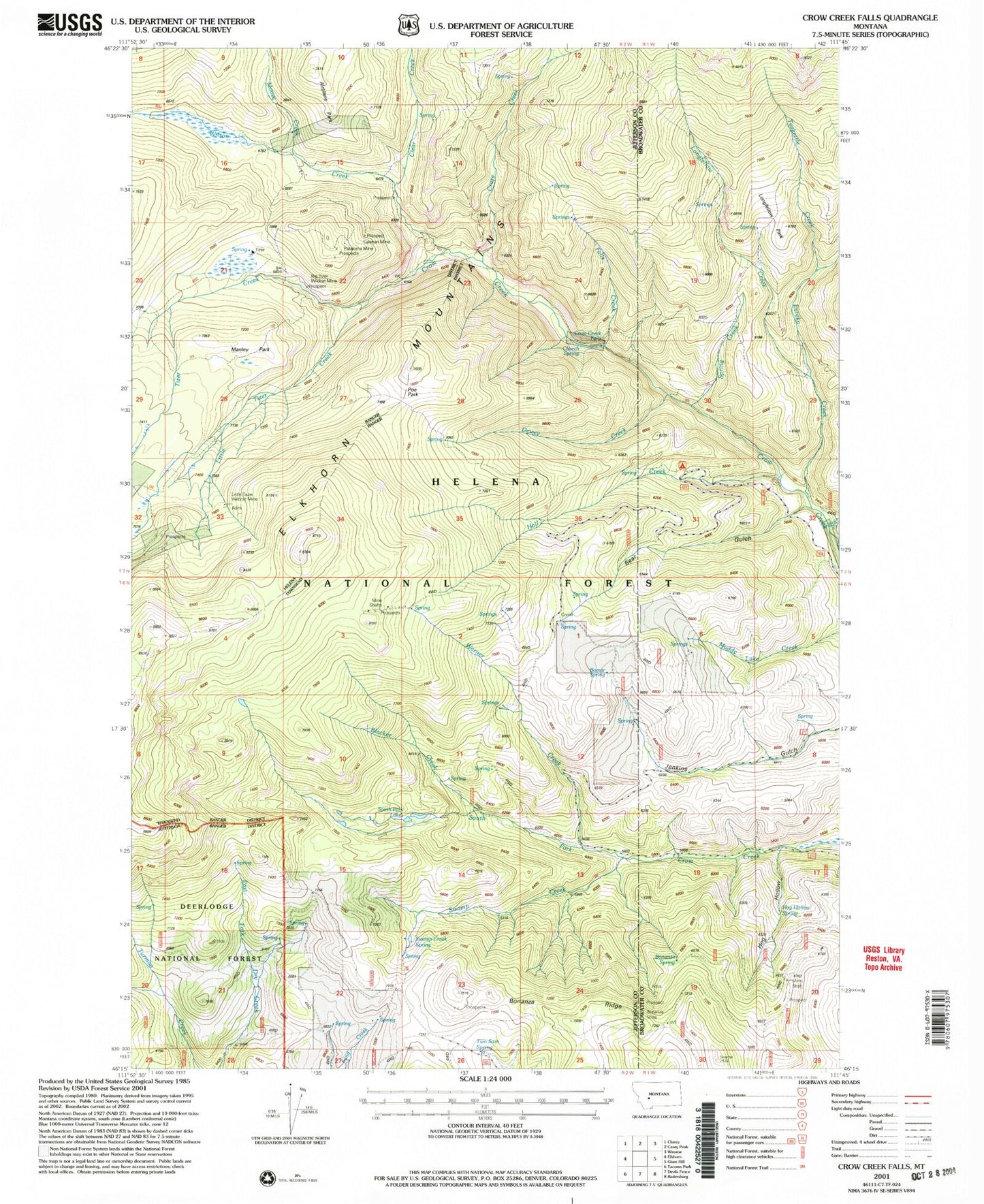
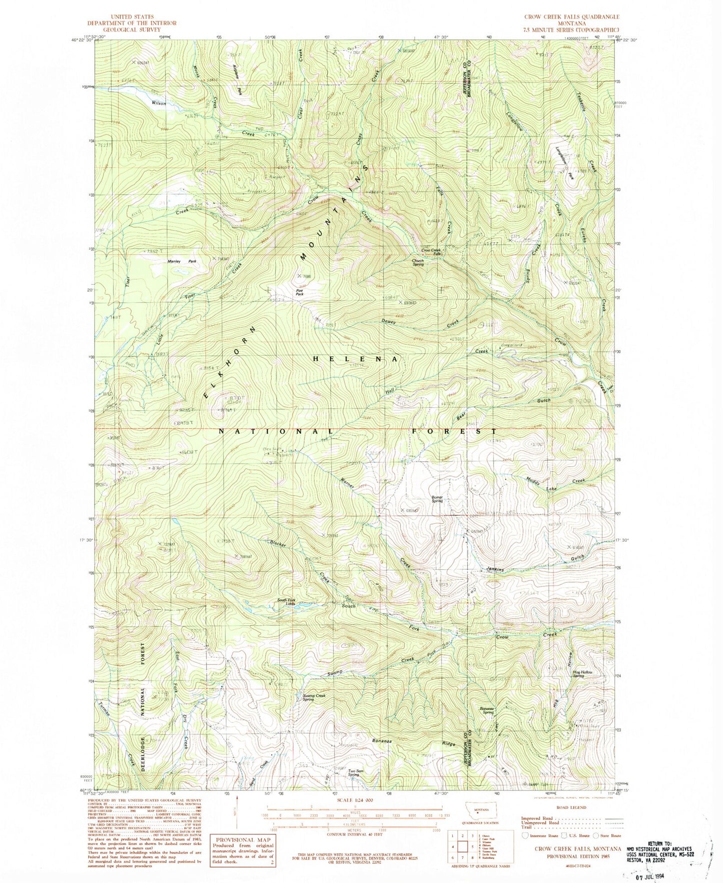
MyTopo
Classic USGS Crow Creek Falls Montana 7.5'x7.5' Topo Map
Couldn't load pickup availability
Historical USGS topographic quad map of Crow Creek Falls in the state of Montana. Map scale may vary for some years, but is generally around 1:24,000. Print size is approximately 24" x 27"
This quadrangle is in the following counties: Broadwater, Jefferson.
The map contains contour lines, roads, rivers, towns, and lakes. Printed on high-quality waterproof paper with UV fade-resistant inks, and shipped rolled.
Contains the following named places: Ballard Mine, Bear Gulch, Big Tizer Creek, Big Tizer Wildcat Mine, Blacker Creek, Bomar Spring, Bonanza Mine, Bonanza Ridge, Bonanza Spring, Boulaway Mine, Calahan Mine, Calahan/Pataloma Mine, Church Spring, Clear Creek, Crazy Creek, Crow Creek Falls, Dewey Creek, Eagle Creek, Elkhorn Mountains, Eureka Creek, Falls Creek, Gold Dust, Gold Dust Post Office, Golden Age Mine, Hall Creek, Hog Hollow, Hog Hollow Mine, Hog Hollow Spring, Little Tizer Creek, Little Tizer Wildcat Mine, Longfellow Creek, Longfellow Park, Manley Park, Moose Creek, NE NE Section 3 Mine, Pataloma Mine, Poe Park, Slim Sam Basin, South Fork Lakes, Spring Creek, Swamp Creek, Swamp Creek Spring, Teakettle Creek, Tizer Ranger Station, Two Sam Spring, Warner Creek, Wilson Creek