MyTopo
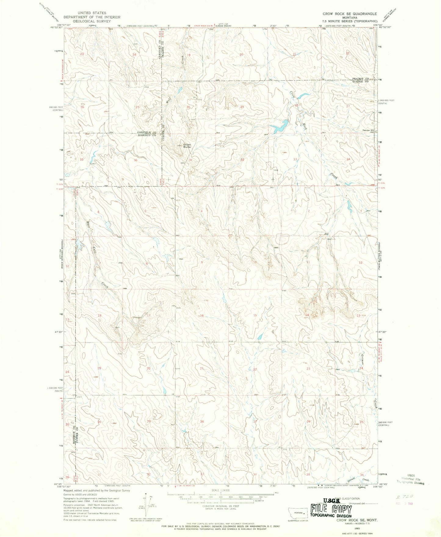
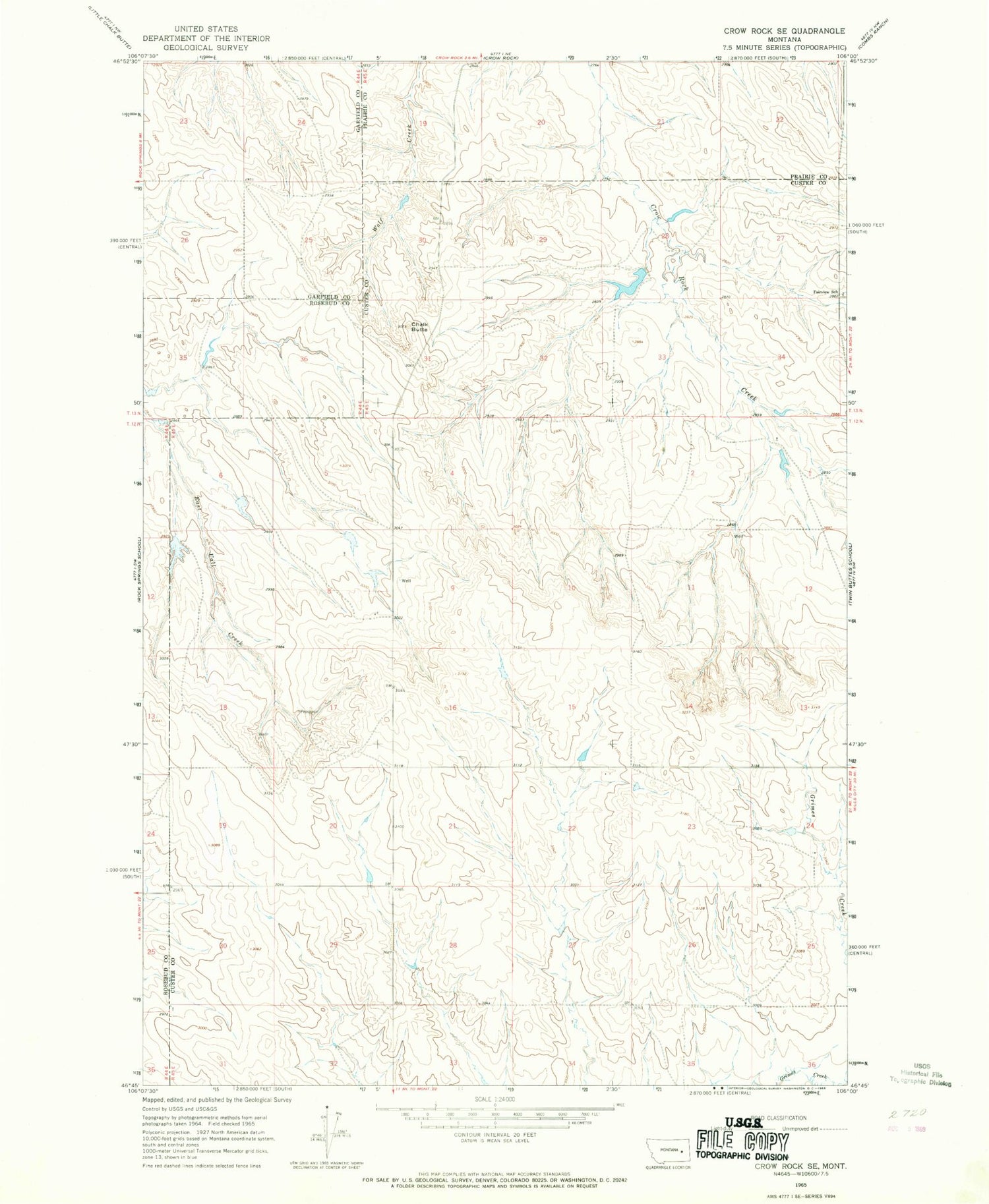
Classic USGS Crow Rock SE Montana 7.5'x7.5' Topo Map
Couldn't load pickup availability
Historical USGS topographic quad map of Crow Rock SE in the state of Montana. Map scale may vary for some years, but is generally around 1:24,000. Print size is approximately 24" x 27"
This quadrangle is in the following counties: Custer, Garfield, Prairie, Rosebud.
The map contains contour lines, roads, rivers, towns, and lakes. Printed on high-quality waterproof paper with UV fade-resistant inks, and shipped rolled.
Contains the following named places: 12N45E01BBDD01 Well, 12N45E03BABB01 Well, 12N45E08DACD01 Well, 12N45E09BCCB01 Well, 12N45E11AAAA01 Well, 12N45E18DADD01 Well, 12N45E20AAAA01 Well, 12N45E22AABB01 Well, 12N45E26CAAD01 Well, 12N45E28CBDD01 Well, 12N45E31BBBB01 Well, 12N45E32ACBC01 Well, 13N45E27DDDD01 Well, 13N45E28AADC01 Well, B-6 Number 4 Dam, Chalk Butte, Doran Dam, Doran Number 1 Dam, Fairview School, Rose School, Sisson School