MyTopo
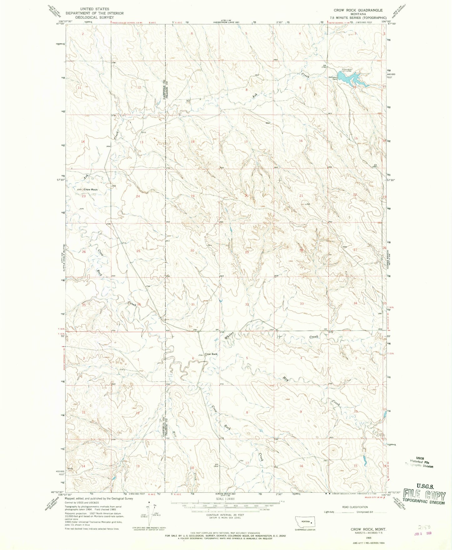
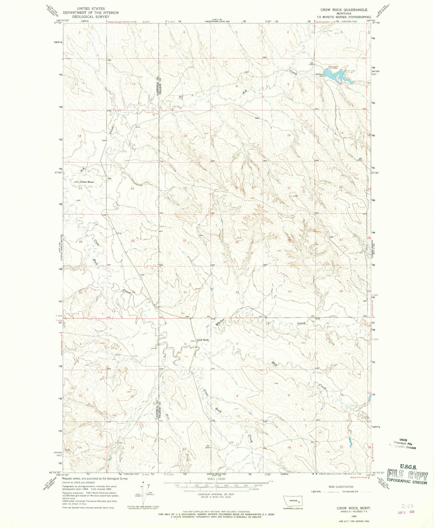
Classic USGS Crow Rock Montana 7.5'x7.5' Topo Map
Couldn't load pickup availability
Historical USGS topographic quad map of Crow Rock in the state of Montana. Map scale may vary for some years, but is generally around 1:24,000. Print size is approximately 24" x 27"
This quadrangle is in the following counties: Garfield, Prairie.
The map contains contour lines, roads, rivers, towns, and lakes. Printed on high-quality waterproof paper with UV fade-resistant inks, and shipped rolled.
Contains the following named places: 13N45E04CCDA01 Well, 13N45E06ADCC01 Well, 13N45E06DAAA01 Well, 14N44E13BACA01 Well, 14N44E14CDCC01 Well, 14N45E03CAAB01 Well, 14N45E07CDAB01 Well, 14N45E07DBDC01 Well, 14N45E17AADA01 Well, Ash Creek Dam, Crow Rock, Crow Rock Post Office, Dinosaur Dam, Hay Creek, Hay Creek School, Lincoln School, Whites Creek, Wolf Creek