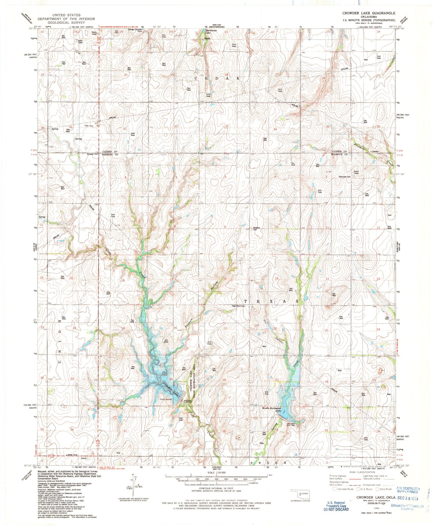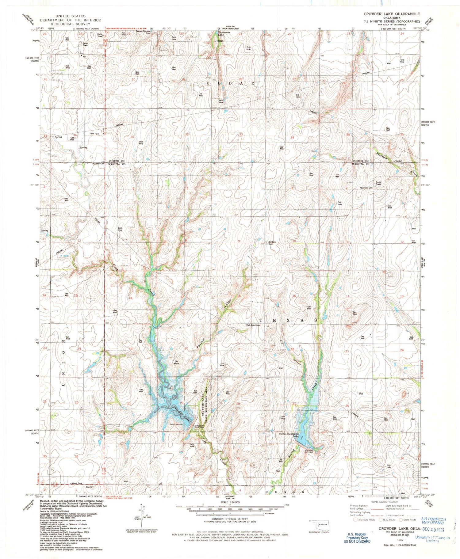
MyTopo
Classic USGS Crowder Lake Oklahoma 7.5'x7.5' Topo Map
Couldn't load pickup availability
Historical USGS topographic quad map of Crowder Lake in the state of Oklahoma. Map scale may vary for some years, but is generally around 1:24,000. Print size is approximately 24" x 27"
This quadrangle is in the following counties: Custer, Washita.
The map contains contour lines, roads, rivers, towns, and lakes. Printed on high-quality waterproof paper with UV fade-resistant inks, and shipped rolled.
Contains the following named places: Bethany Cemetery, Cartwright Dam, Cobb Creek Site 1 Dam, Cobb Creek Site 1 Reservoir, Cobb Creek Site 3 Dam, Cobb Creek Site 3 Reservoir, Crissman Reservoir, Crissmon Dam, Crowder Lake, Crowder Lake State Recreation Area, Dickey Reservoir, Don F Dickey Dam, Dry Canyon, High Point Cemetery, Missouri Cemetery, Oknoname 149002 Dam, Oknoname 149002 Reservoir, Oknoname 149005 Dam, Oknoname 149005 Reservoir, Oknoname 149006 Dam, Oknoname 149006 Reservoir, Oknoname 149013 Dam, Oknoname 149013 Reservoir, Oknoname 149017 Dam, Oknoname 149017 Reservoir, Oknoname 149018 Dam, Oknoname 149018 Reservoir, Oknoname 149023 Dam, Oknoname 149023 Reservoir, Oknoname 149035 Dam, Oknoname 149035 Reservoir, Oknoname 149037 Dam, Oknoname 149037 Reservoir, Plainview Cemetery, Plainview Church, Possum Hollow, Township of Texas, Worth Richmond Lake