MyTopo
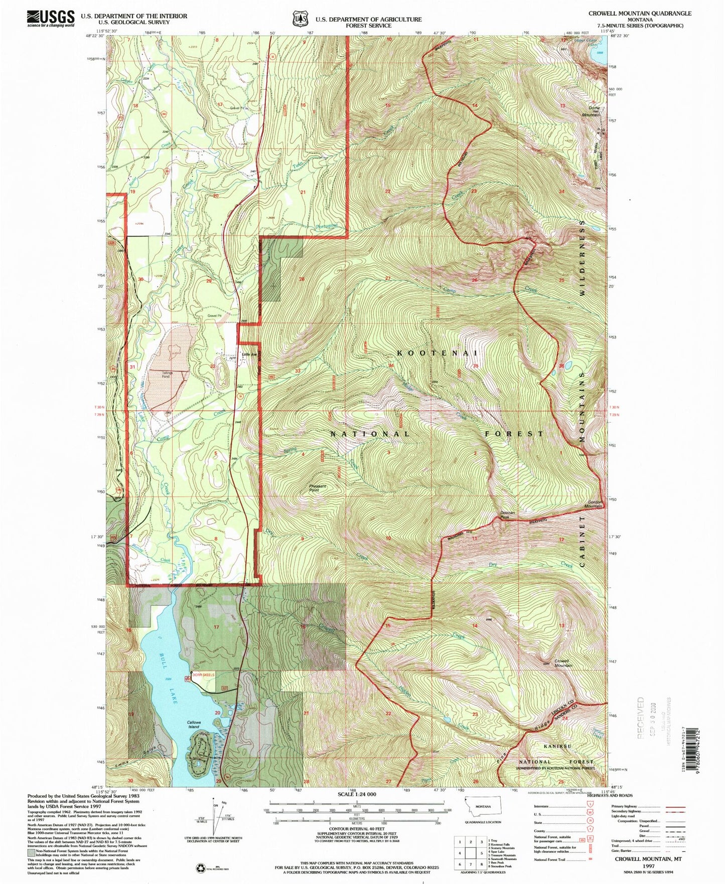
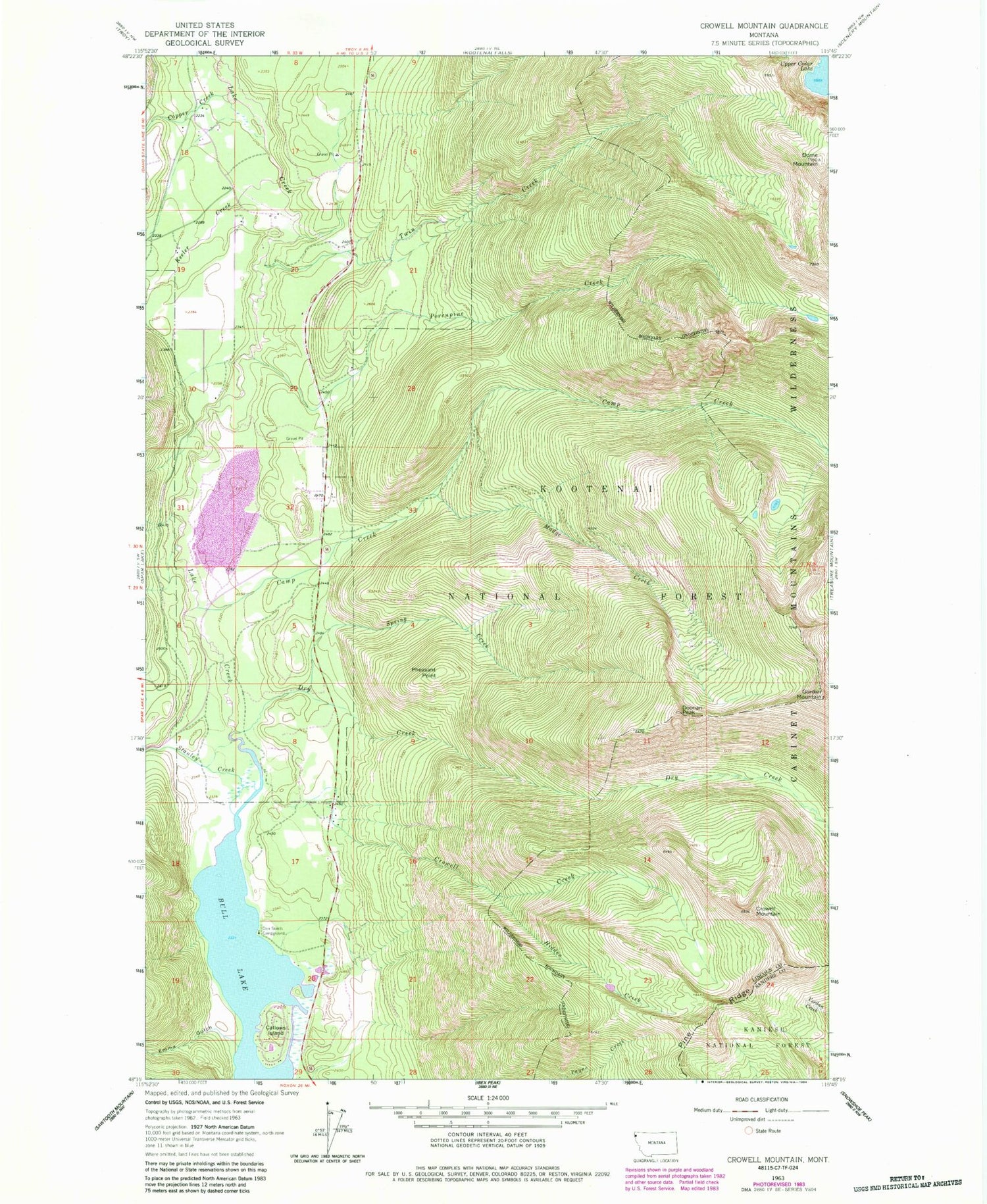
Classic USGS Crowell Mountain Montana 7.5'x7.5' Topo Map
Couldn't load pickup availability
Historical USGS topographic quad map of Crowell Mountain in the state of Montana. Map scale may vary for some years, but is generally around 1:24,000. Print size is approximately 24" x 27"
This quadrangle is in the following counties: Lincoln, Sanders.
The map contains contour lines, roads, rivers, towns, and lakes. Printed on high-quality waterproof paper with UV fade-resistant inks, and shipped rolled.
Contains the following named places: 29N33W08BDAC01 Well, 29N33W17AABB01 Well, 29N33W17AACC01 Well, 29N33W17ABAA01 Well, 29N33W17ACAA01 Well, 29N33W17ACAA02 Well, 29N33W20CCDA01 Well, 29N33W20CCDC01 Well, 29N33W20CDBD01 Well, 29N33W29ACBA01 Well, 30N33W17BCCB01 Well, 30N33W18AACC01 Well, 30N33W18ACDB01 Well, 30N33W18ACDD01 Well, 30N33W19ACCC01 Well, 30N33W20AADB01 Well, 30N33W20ADDC01 Well, 30N33W20BBAB01 Well, 30N33W20BBBC01 Well, 30N33W20DCCA01 Well, 30N33W29ACDC01 Well, 30N33W29DABC01 Well, 30N33W29DCAC01 Well, 30N33W30DAAD01 Well, 30N33W30DAAD02 Well, 30N33W30DCAD01 Well, 30N33W30DCAD02 Well, 30N33W31AAAC01 Well, 30N33W31DCBD01 Well, 30N33W32ABDB01 Well, 30N33W32ACAD01 Well, 30N33W32ACBD01 Well, 30N33W32ACDB01 Well, 30N33W32ADCA01 Well, 30N33W32ADCB01 Well, Bull Lake Volunteer Fire Department, Callows Island, Camp Creek, Copper Creek, Crowell Creek, Crowell Mountain, Crowell Trail, Dome Mountain, Doonan Peak, Dorr Skeels Campground, Dry Creek, Emma Gulch, Gordon Mountain, Halfway House, Hidden Creek, Keeler Creek, Little Joe, Madge Creek, Pheasant Point, Pine Ridge, Porcupine Creek, Spring Creek, Stanley Creek, Twin Creek, Upper Cedar Lake