MyTopo
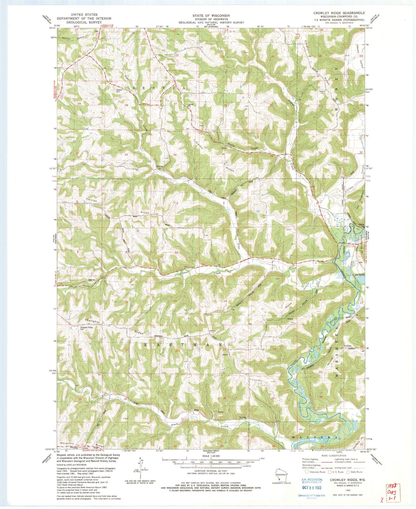
Classic USGS Crowley Ridge Wisconsin 7.5'x7.5' Topo Map
Couldn't load pickup availability
Historical USGS topographic quad map of Crowley Ridge in the state of Wisconsin. Map scale may vary for some years, but is generally around 1:24,000. Print size is approximately 24" x 27"
This quadrangle is in the following counties: Crawford.
The map contains contour lines, roads, rivers, towns, and lakes. Printed on high-quality waterproof paper with UV fade-resistant inks, and shipped rolled.
Contains the following named places: Burton School, Citron Creek, Citron Valley, Crawford County, Crawford County Infirmary, Crowley Ridge, Dean School, Duffy Creek, Dunne School, Grandow School, Niland Ridge, Otter Creek, Pine Creek, Pleasant Ridge, Pleasant Ridge School, Progressvie Ridge School, Shanghai Ridge, Shanghai Ridge Cemetery, Stuart Cemetery, Swatek Ridge, Swatek School, Town of Eastman, Valley View School, Walker Hollow, ZIP Code: 54657