MyTopo
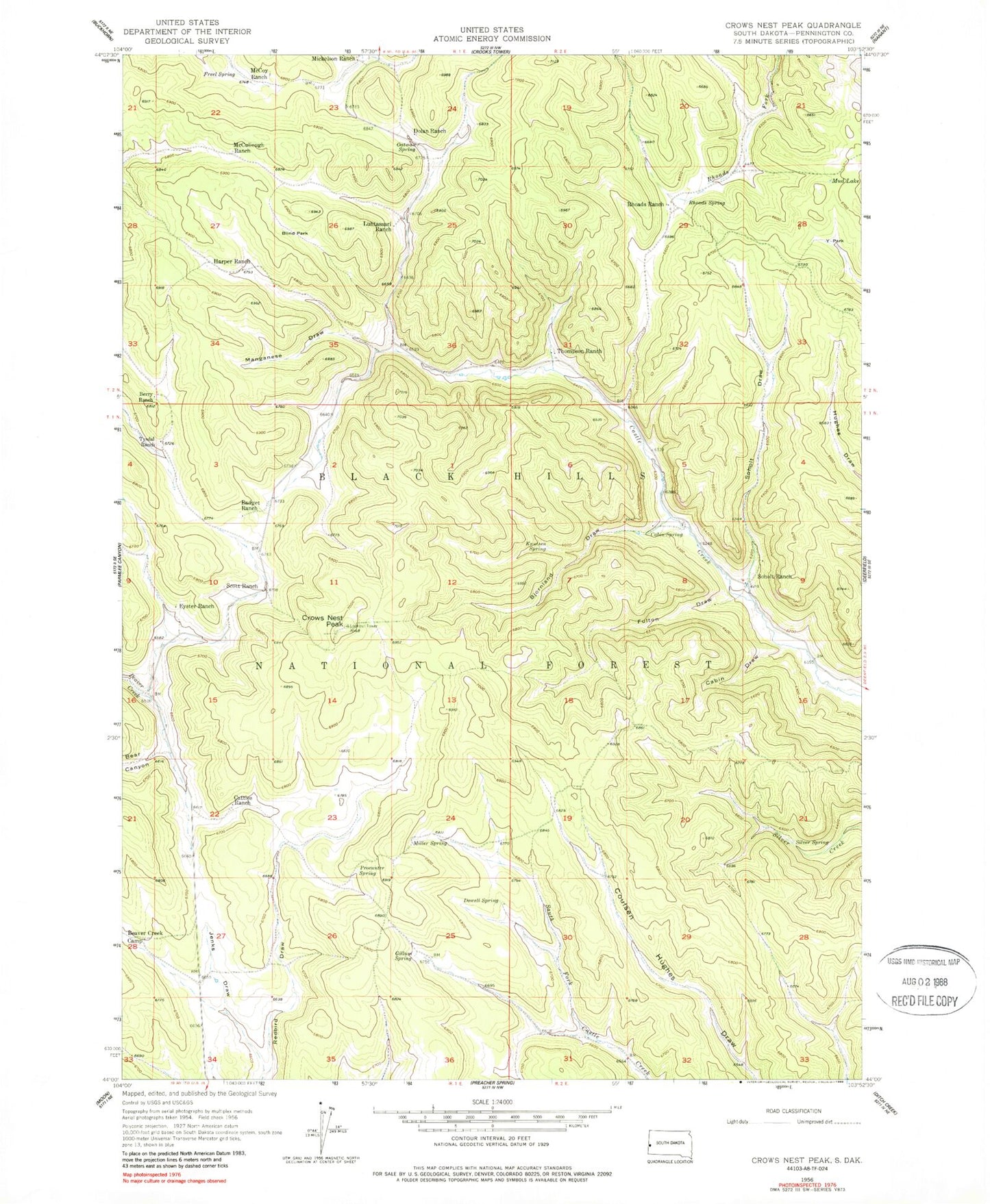
Classic USGS Crows Nest Peak South Dakota 7.5'x7.5' Topo Map
Couldn't load pickup availability
Historical USGS topographic quad map of Crows Nest Peak in the state of South Dakota. Typical map scale is 1:24,000, but may vary for certain years, if available. Print size: 24" x 27"
This quadrangle is in the following counties: Pennington.
The map contains contour lines, roads, rivers, towns, and lakes. Printed on high-quality waterproof paper with UV fade-resistant inks, and shipped rolled.
Contains the following named places: Badget Ranch, Beaver Creek Camp, Berry Ranch, Bjornland Draw, Blind Park, Cabin Draw, Cabin Spring, Cattles Ranch, Crows Nest Peak, Dolan Ranch, Dowell Spring, Eyster Ranch, Freel Spring, Fulton Draw, Gillum Spring, Harper Ranch, Jenks Draw, Knutsen Spring, Luhtasaari Ranch, Manganese Draw, McCoy Ranch, McCullough Ranch, Mickelson Ranch, Miller Spring, Mud Lake, Oatman Spring, Procunter Spring, Rhoads Ranch, Rhoads Spring, Scott Ranch, Silver Spring, Soholt Draw, Soholt Ranch, Thompson Ranch, Tysdal Ranch, Mud Lake Gravel Pit, Y-Park