
MyTopo
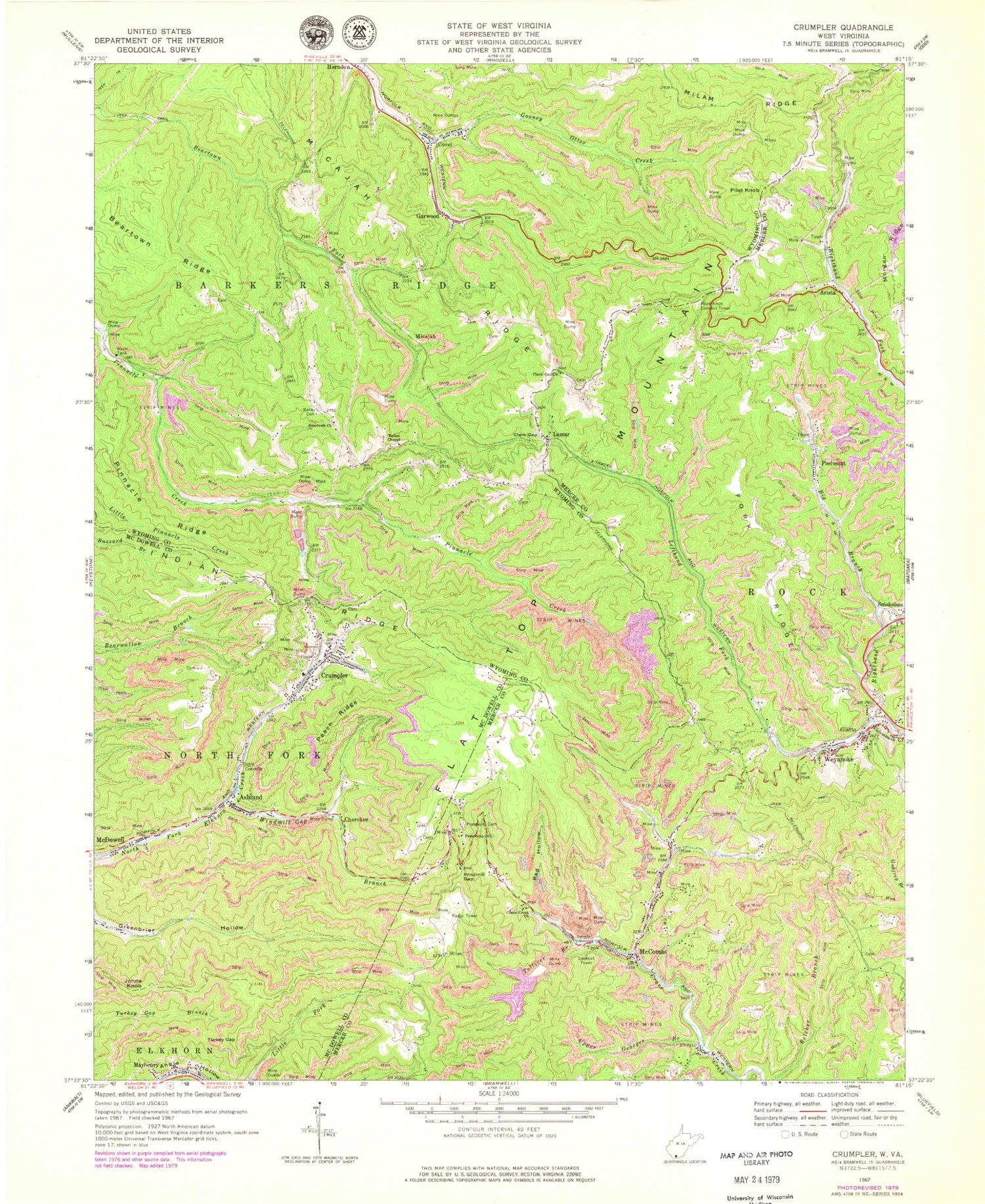
Classic USGS Crumpler West Virginia 7.5'x7.5' Topo Map
Couldn't load pickup availability
Historical USGS topographic quad map of Crumpler in the state of West Virginia. Typical map scale is 1:24,000, but may vary for certain years, if available. Print size: 24" x 27"
This quadrangle is in the following counties: McDowell, Mercer, Wyoming.
The map contains contour lines, roads, rivers, towns, and lakes. Printed on high-quality waterproof paper with UV fade-resistant inks, and shipped rolled.
Contains the following named places: Angle Hollow, Bailey Cemetery, Bailey Chapel, Beartown Church, Beartown Ridge, Big Branch, Clark Gap, Clark Gap Church, Crane Creek Church, Fork Ridge, Lefthand Fork Widemouth Creek, McComas, Peach Ridge, Pinnacle Ridge, Prosperity Cemetery, Prosperity School (historical), Red Hollow, Righthand Fork Widemouth Creek, Taylor School (historical), Tolliver Branch, Turkey Gap, Upper Georges Branch, Windmill Gap, Windmill Gap Branch, Arista, Ashland, Cherokee, Covel, Crumpler, Garwood, Giatto, Johns Knob, Lamar, Micajah, Piedmont, Pilot Knob, Smokeless, Weyanoke, Algonquin (historical), Giatto School (historical), Lowe (historical), McComas High School (historical), Peters Gap, Widemouth (historical), Harry S Thomas Spring, Pilot Knob Lookout Tower, Tolliver Branch Dam, Tolliver Branch Lake, Boyds Branch Refuse Dam, Lefthand Fork Dam, East Fork of Crane Creek Dam, Payne Branch Dam, Crumpler Impoundment Number Two, Gooney Otter Creek Dam, Beartown Fork Dam, McComas Post Office, Dwight Shrewsbury Spring, Ashland Post Office, Crumpler Post Office, Black, Covel Missionary Baptist Church, Covel Post Office, Covel Census Designated Place, Crumpler Census Designated Place


