
MyTopo
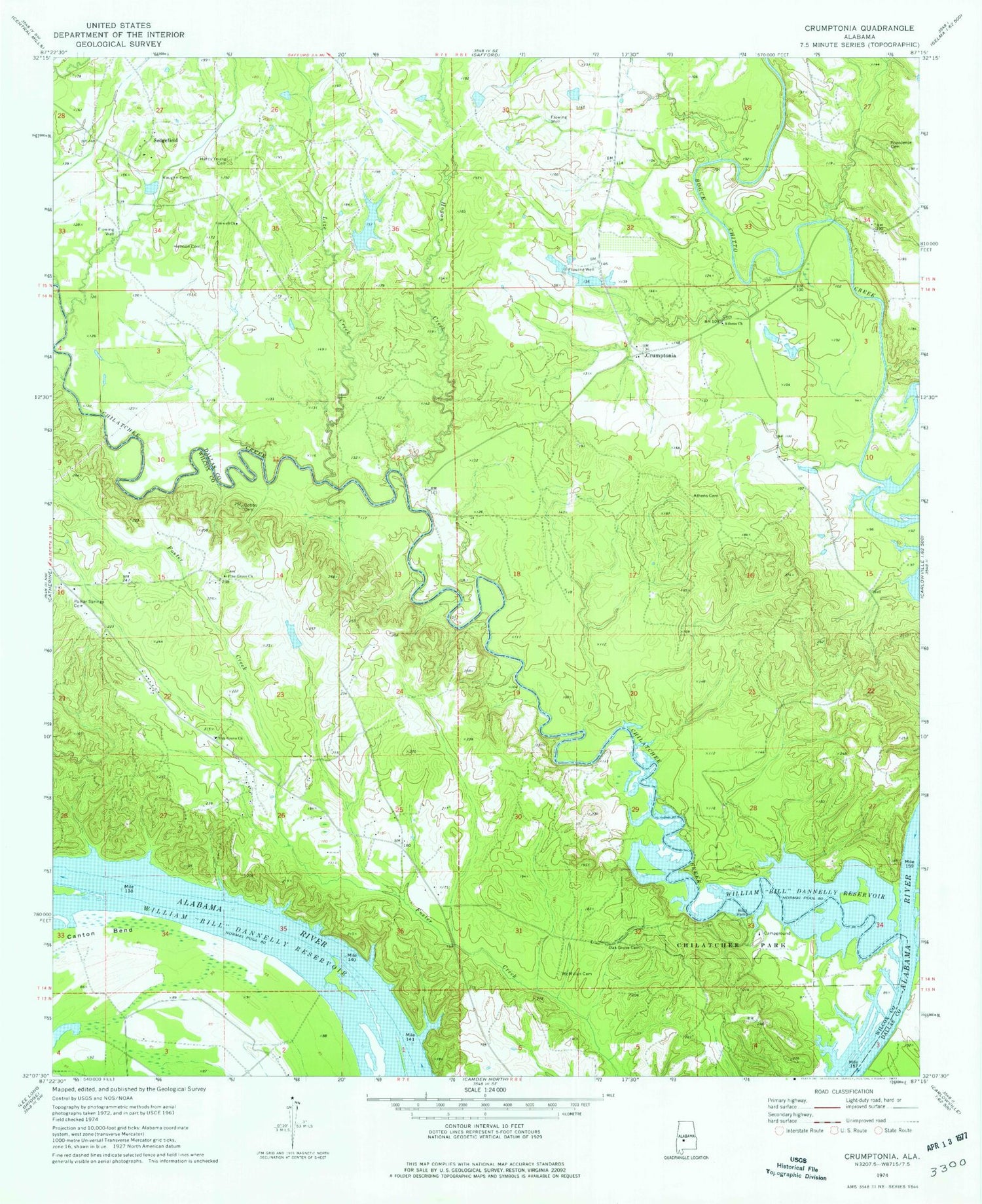
Classic USGS Crumptonia Alabama 7.5'x7.5' Topo Map
Couldn't load pickup availability
Historical USGS topographic quad map of Crumptonia in the state of Alabama. Map scale may vary for some years, but is generally around 1:24,000. Print size is approximately 24" x 27"
This quadrangle is in the following counties: Dallas, Wilcox.
The map contains contour lines, roads, rivers, towns, and lakes. Printed on high-quality waterproof paper with UV fade-resistant inks, and shipped rolled.
Contains the following named places: Aeola Landing, Aimwell Church, Athens Baptist Church, Athens Cemetery, Bennetts Store, Cambridge Post Office, Chilatchee Creek, Chilatchee Park, Cobbs Cemetery, Cobbs Quarters, Crumptonia, Ellis, Hardy Young Cemetery, Hennon Cemetery, Hogan Creek, Lize Creek, McMillan Cemetery, Morning Star Church, Oak Grove Cemetery, Oak Grove Church, Parks Landing, Pine Grove Church, Poplar Springs Cemetery, Providence Cemetery, Providence Presbyterian Church, Red Bluff, Retreat Post Office, Sedgefield, Sedgefield Lake, Sedgefield Lake Dam, Sprague Landing, Vaughn Cemetery, ZIP Code: 36720


