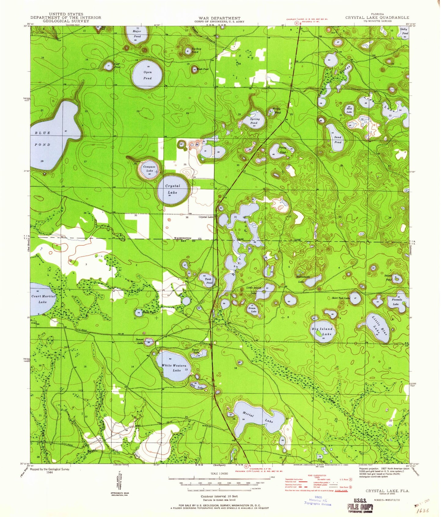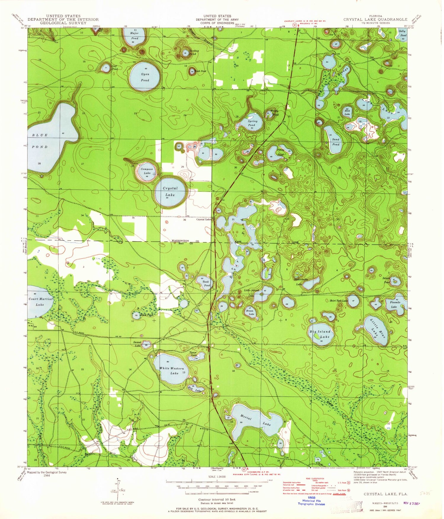
MyTopo
Classic USGS Crystal Lake Florida 7.5'x7.5' Topo Map
Couldn't load pickup availability
Historical USGS topographic quad map of Crystal Lake in the state of Florida. Map scale may vary for some years, but is generally around 1:24,000. Print size is approximately 24" x 27"
This quadrangle is in the following counties: Bay, Washington.
The map contains contour lines, roads, rivers, towns, and lakes. Printed on high-quality waterproof paper with UV fade-resistant inks, and shipped rolled.
Contains the following named places: Big Blue Lake, Big Island Lake, Bird Lake, Black Pond, Bream Lake, Brit Lake, Calf Lake, Clearwater Branch, CML Airport, Compass Lake, Court Martial Lake, Crystal Lake, Crystal Village Airport, Gator Pond, Greenhead Volunteer Fire Department, Island Pond, Lake Five-O, Little Blue Lake, Little Island Lake, Log Cart Pond, Long Lake, Long Lake Slough, Lower Spring Ponds, Major Lake, Merial Lake, North Spring Lake, Open Lake, Piney Lake, Rattlesnake Lake, River Lake, Sand Hills Volunteer Fire Department, Sand Lake, Shirt Tail Lake, Sunset Lake, Tank Pond, Turkey Pond, Tyson Lake, Wash Pond, White Western Lake, Woody Pond, WPFM-FM (Panama City)