MyTopo
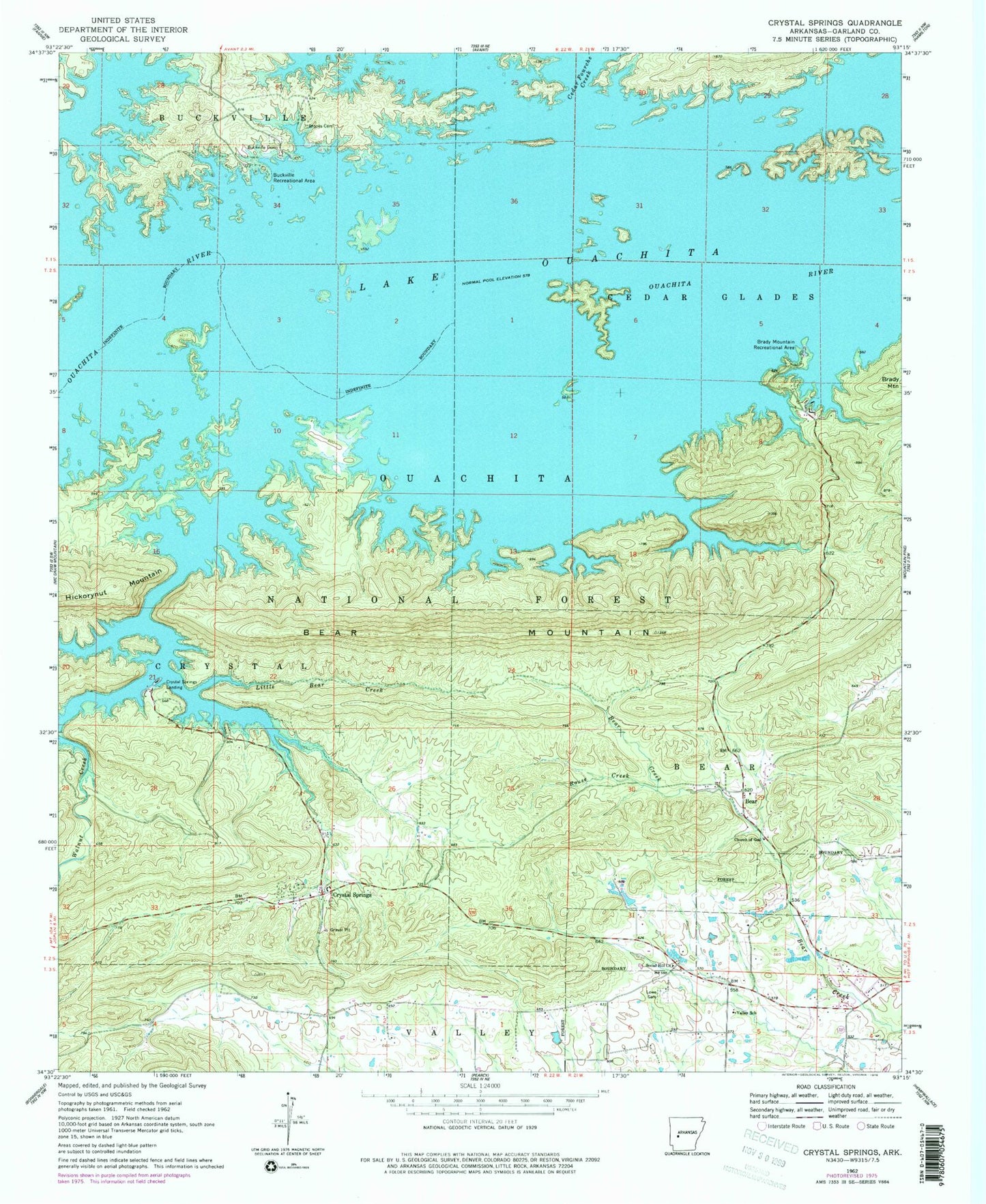
Classic USGS Crystal Springs Arkansas 7.5'x7.5' Topo Map
Couldn't load pickup availability
Historical USGS topographic quad map of Crystal Springs in the state of Arkansas. Typical map scale is 1:24,000, but may vary for certain years, if available. Print size: 24" x 27"
This quadrangle is in the following counties: Garland.
The map contains contour lines, roads, rivers, towns, and lakes. Printed on high-quality waterproof paper with UV fade-resistant inks, and shipped rolled.
Contains the following named places: Township of Bear (historical), Bucksville (historical), Township of Cedar Glades (historical), Church of God, Crystal Springs Public Use Area, Township of Crystal (historical), Township of Valley (historical), Bear Mountain, Brooks Cemetery, New Cedar Glades Cemetery, Cedar Fourche Creek, Crystal Springs Landing, Little Bear Creek, Lowe Cemetery, Rouse Creek, Social Hill Church, Valley School, Walnut Creek, Crystal Springs Recreation Site, Lake Ouachita, Bear, Brady Mountain Public Use Area, Buckville Public Use Area, Crystal Springs, Arkansas Noname 136 Dam, Arkansas Noname 136 Reservoir, Rector Lake Dam, Rector Lake, Cedar Glades (historical), Piney Fire Department Station 3, Crystal Springs Census Designated Place