MyTopo
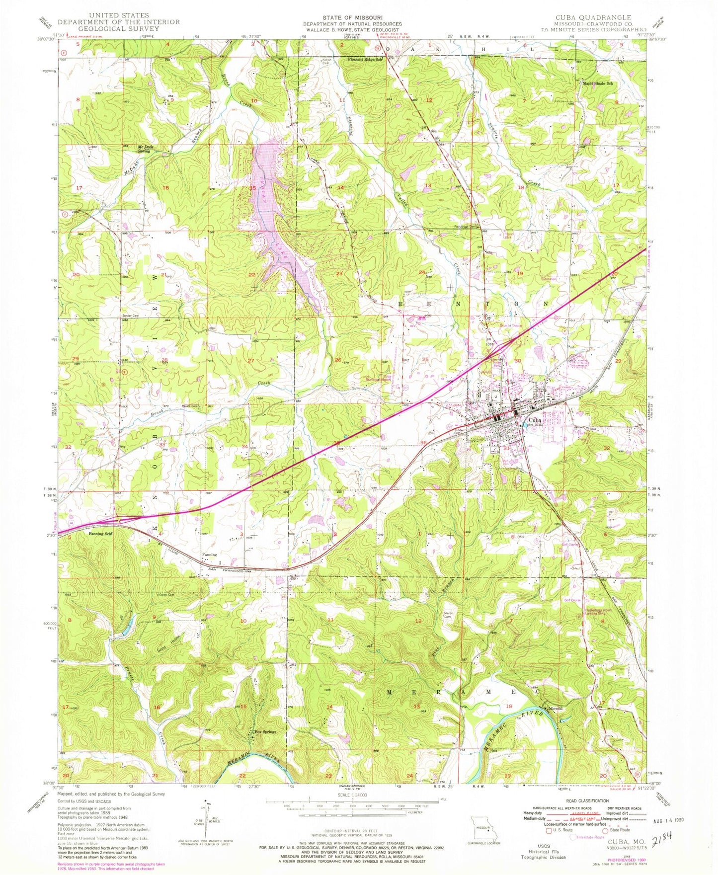
Classic USGS Cuba Missouri 7.5'x7.5' Topo Map
Couldn't load pickup availability
Historical USGS topographic quad map of Cuba in the state of Missouri. Map scale may vary for some years, but is generally around 1:24,000. Print size is approximately 24" x 27"
This quadrangle is in the following counties: Crawford.
The map contains contour lines, roads, rivers, towns, and lakes. Printed on high-quality waterproof paper with UV fade-resistant inks, and shipped rolled.
Contains the following named places: Amanda, Castanis Lake, Castanis Lake Dam, City of Cuba, Cuba, Cuba Fire Department House 1, Cuba Municipal Airport, Cuba Police Department, Cuba Post Office, Cuba Volunteer Fire Department Station 2, Durbin Lake, Durbin Lake Dam, Elders Lake, Elders Lake Dam, Fairclough Cemetery, Fairclough Episcopal Church, Fanning, Fanning School, Fox Springs, Gould Lake, Gould Lake Dam, Grant Hollow, Green Cemetery, Hartnett Lake, Hartnett Lake Dam, Hedrick Lake, Hedrick Lake Dam, Heron Cemetery, Idlewild, Indian Hills Dam, Indian Lake, Indian Lake Census Designated Place, Iron Center, Iron Center School, Iron Ridge Number One Iron Bank, Iron Ridge Number Two Iron Bank, Iron Ridge School, Isabella Iron Bank, J.P. Card and Companys Iron Bank, Kamler Lake, Kamler Lake Dam, Keeney Lake, Keeney Lake Dam, Kinder Cemetery, Lerwick Lake, Lerwick Lake Dam, Maple Shade School, Martin Cemetery, McDade Branch, McDade Spring, Mount Cemetery, Oak Grove School, Oak Shade School, Pine Branch, Pinnel Iron Mine, Pleasant Ridge School, Rutz Lake, Rutz Lake Dam, Senator Bucklands Iron Bank, Sutter Lake, Sutter Lake Dam, Township of Knobview, Varris Iron Mine, Vine Hill School, Weisel Lake, Weisel Lake Dam, Zenser Cemetery, ZIP Code: 65453