MyTopo
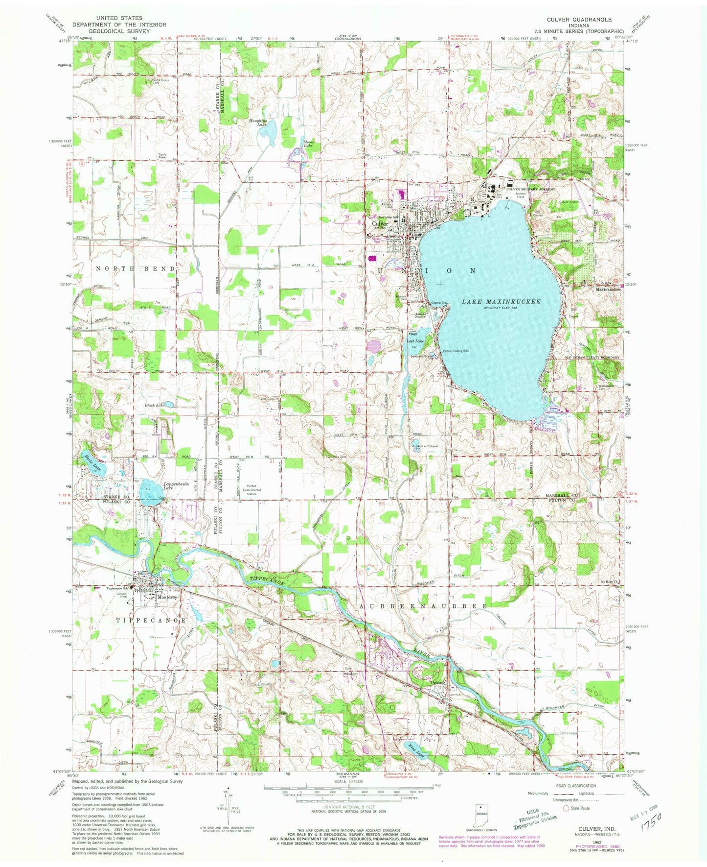
Classic USGS Culver Indiana 7.5'x7.5' Topo Map
Couldn't load pickup availability
Historical USGS topographic quad map of Culver in the state of Indiana. Map scale may vary for some years, but is generally around 1:24,000. Print size is approximately 24" x 27"
This quadrangle is in the following counties: Fulton, Marshall, Pulaski, Starke.
The map contains contour lines, roads, rivers, towns, and lakes. Printed on high-quality waterproof paper with UV fade-resistant inks, and shipped rolled.
Contains the following named places: Chapman Ditch, Collins Ditch, Cromley Cemetery, Culver, Culver Community Junior-Senior High School, Culver Elementary School, Culver Military and Girls Academy, Culver Police Department, Culver Post Office, Culver Union Township Ambulance Service, Culver Union Township Fire Department, Curtiss Ditch, Delong, Delong Post Office, Demont Arm, Fleet Field, Hartz Lake, Hawkins Ditch, Houghton Lake, Jacks Field, King Lake, Lake Maxinkuckee, Langenbahn Lake, Lost Lake, Lowry Ditch, Masonic Cemetery, Maxinkuckee, Monterey, Monterey Elementary School, Monterey Post Office, Monterey Volunteer Fire Department, Moore Lake, Mount Hope Church, North Union Cemetery, Riverside Memorial Cemetery, Slonaker Ditch, Thompson Ditch, Tippecanoe School, Town of Culver, Town of Monterey, Township of Aubbeenaubbee, Township of Union, Wagoner Ditch, Washington Cemetery, Williams Arm Ditch, Wilson Ditch, Zechiel Arm, Zion Cemetery, ZIP Codes: 46511, 46922