MyTopo
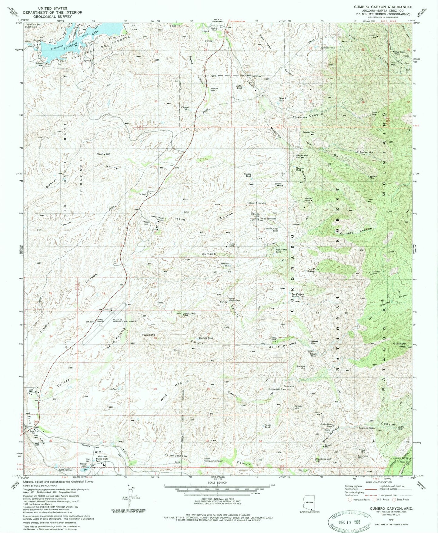
Classic USGS Cumero Canyon Arizona 7.5'x7.5' Topo Map
Couldn't load pickup availability
Historical USGS topographic quad map of Cumero Canyon in the state of Arizona. Map scale may vary for some years, but is generally around 1:24,000. Print size is approximately 24" x 27"
This quadrangle is in the following counties: Santa Cruz.
The map contains contour lines, roads, rivers, towns, and lakes. Printed on high-quality waterproof paper with UV fade-resistant inks, and shipped rolled.
Contains the following named places: Alisos Well, Ash Canyon, Barriles Tank, Basin Spring, Bennett Mine, Beyerville Census Designated Place, Big Lead Mine, Blue Eagle Mine, Buena Vista Lake, Buena Vista Mine, Canada de la Paloma, Chango Tank, Circle Z Ranch, Cox Gulch, Crescent Spring, Denver Mine, Domino Mine, Douglas Well, European Mine, Flowing Well, Flux Mine, Flux Spring, Fresno Canyon, G Castro, Golden Rose Mine, Grande Tank, Gross Mine, Guajalote Peak, Hangmans Canyon, Isabella Mine, Jarillas Mine, Jarillas Tank, Javelina Well, Jim Dam, King Mine, Kino Springs, Kino Springs Dam, Kino Springs Lake, Lake Patagonia Campground, Little Red School Elementary, Lookout Mine, Los Pajaros Verdes Tank, Lower Paloma Dam, Lower Providencia Tanks, Maggies Canyon, Maggies Mine, Maggies Tank, Maggies Well, Marche Mine, Mary Kane Canyon, Minnesota Mine, National Mine, Nettle Tank, Nogales International Airport, O'Maras Mine, Paja Verde Spring, Paja Verde Tank, Palmetto Mine, Paloma Well, Pasture Well, Patagonia Lake, Patagonia Lake State Park, Proto Canyon, Providencia Canyon, Providencia Storage, Providencia Well, Robert E Lee Mine, Sand Canyon, Sandy Tank, Sanfords, Shamrock Mine, Shannon Spring, Soldier Basin, Sonoita Mine, Stacey Lake, Sycamore Canyon, T 4 Ranch, Tascala Canyon, Tascala Tank, Three R Canyon, Three R Mine, Three R Tank, Tres de Mayo Tank, Tres de Mayo Well, Ventura Mine, Wild Hog Canyon, Yerba Buena Canyon


