MyTopo
Classic USGS Cumero Mountain Arizona 7.5'x7.5' Topo Map
Couldn't load pickup availability
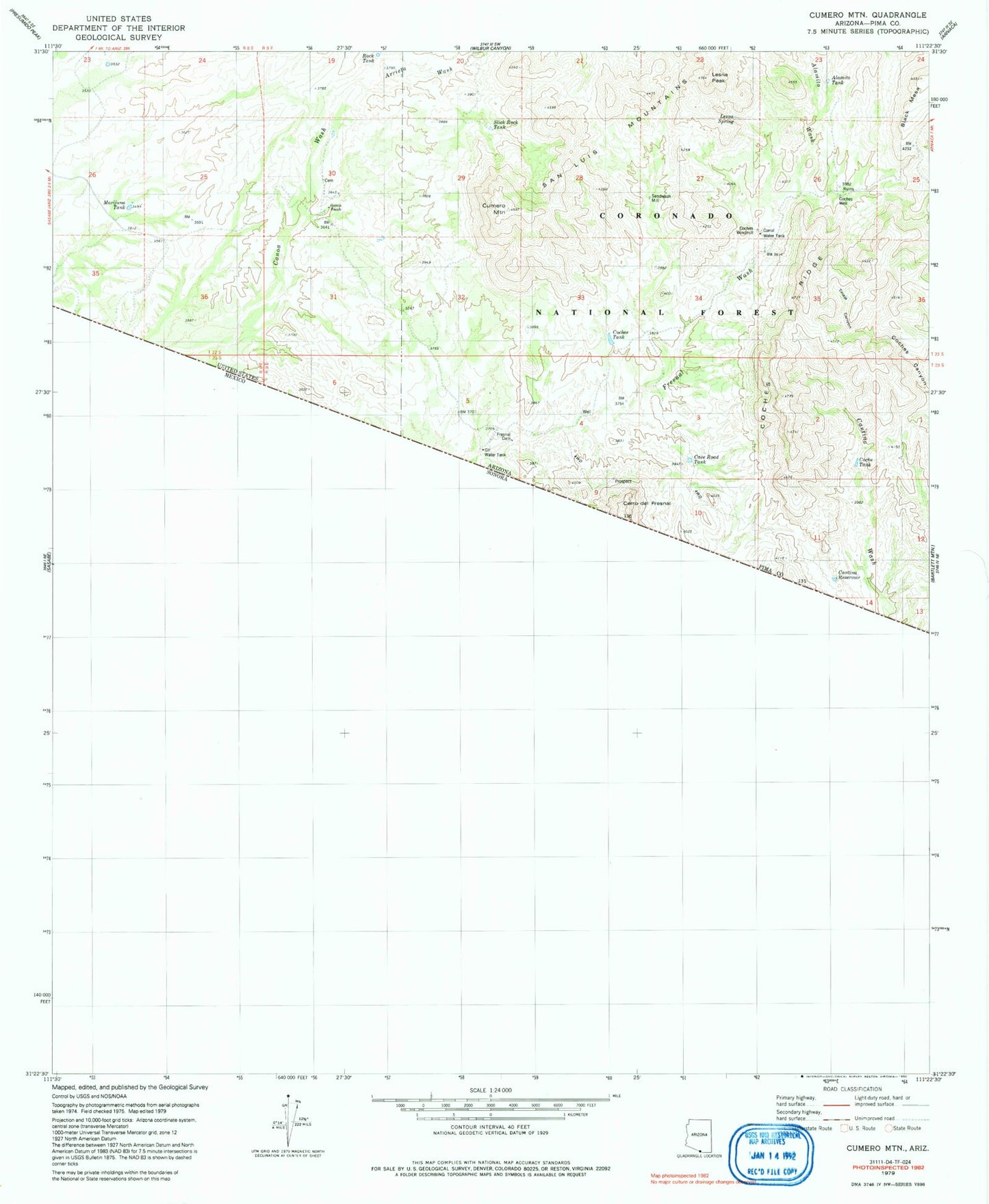
Historical USGS topographic quad map of Cumero Mountain in the state of Arizona. Map scale may vary for some years, but is generally around 1:24,000. Print size is approximately 24" x 27"
This quadrangle is in the following counties: Pima.
The map contains contour lines, roads, rivers, towns, and lakes. Printed on high-quality waterproof paper with UV fade-resistant inks, and shipped rolled.
Contains the following named places: Alamito Tank, Alamito Wash, Arrieta Wash, Black Mesa, Border Mine, Cantina Reservoir, Cave Road Tank, Cerro del Fresnal, Coche Tank, Coches Ridge, Coches Tank, Coches Well, Coches Windmill, Cumero Mountain, Dam Number 1, Dam Number 2, Fresnal Dam, Garcia Ranch, Gil Water Tank, Lesna Peak, Lesna Spring, Marijuna Tank, Rock Tank, Sandwash Mill, Slick Rock Tank, Tinaja Canyon