MyTopo
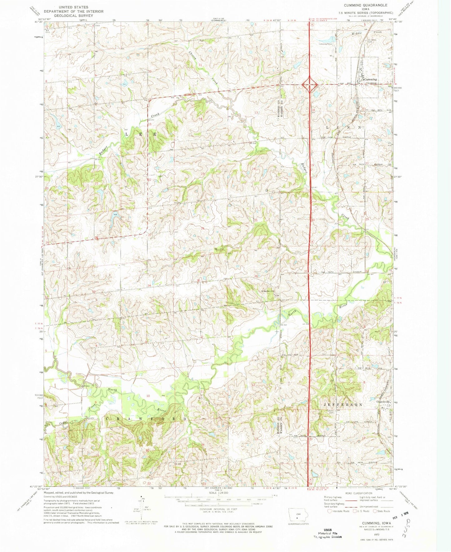
Classic USGS Cumming Iowa 7.5'x7.5' Topo Map
Couldn't load pickup availability
Historical USGS topographic quad map of Cumming in the state of Iowa. Map scale may vary for some years, but is generally around 1:24,000. Print size is approximately 24" x 27"
This quadrangle is in the following counties: Madison, Warren.
The map contains contour lines, roads, rivers, towns, and lakes. Printed on high-quality waterproof paper with UV fade-resistant inks, and shipped rolled.
Contains the following named places: Calvary Cemetery, Cedar Creek, Cherry Creek, Churchville, City of Cumming, Community Church of Cumming, Cumming, Cumming City Park, Cumming Post Office, Cunningham Bridge, Francesca's House, Great Western Trail, Heaton Post Office, Howell Tree Farm, Montpelier Post Office, Saint Johns Catholic Church, Saint Johns Cemetery, Saint Patricks Cemetery, Saint Patricks Church, Township of Crawford, Township of Lee, ZIP Codes: 50061, 50229