MyTopo
Classic USGS Cummings South Carolina 7.5'x7.5' Topo Map
Couldn't load pickup availability
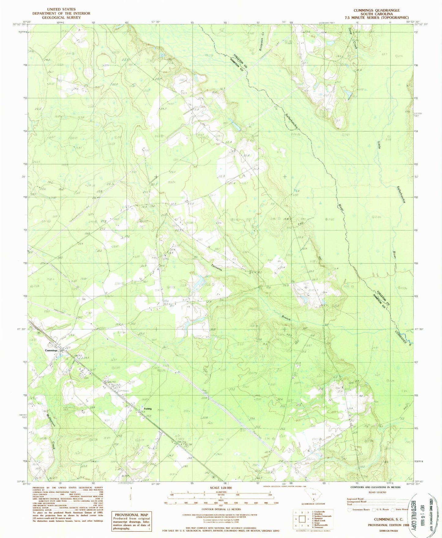
Historical USGS topographic quad map of Cummings in the state of South Carolina. Map scale may vary for some years, but is generally around 1:24,000. Print size is approximately 24" x 27"
This quadrangle is in the following counties: Colleton, Hampton.
The map contains contour lines, roads, rivers, towns, and lakes. Printed on high-quality waterproof paper with UV fade-resistant inks, and shipped rolled.
Contains the following named places: Annie Laurie Church, Antioch Church, Antioch School, Big Pond, Broadwater School, Crews Cemetery, Cummings, Deep Branch Church, Deep Creek, Fechtig, Hampton Fire Department Station 90, Holiness Church, Horse Bay, Huggin Oak Church of God, Huggins Oak School, Jerusalem Church, Jerusalem School, Little Salkehatchie River, Mount Olive Church, Ricepatch Creek, Rocky Branch School, Saint Johns School, Salkehatchie River, South Carolina Noname 25012 D-2599 Dam, Tennants Branch, Tram Road School, Varntown