MyTopo
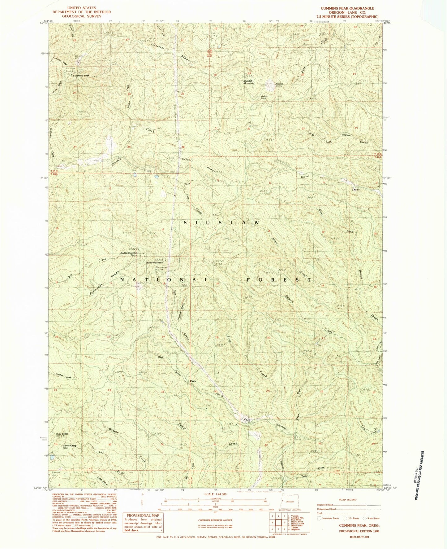
Classic USGS Cummins Peak Oregon 7.5'x7.5' Topo Map
Couldn't load pickup availability
Historical USGS topographic quad map of Cummins Peak in the state of Oregon. Map scale may vary for some years, but is generally around 1:24,000. Print size is approximately 24" x 27"
This quadrangle is in the following counties: Lane.
The map contains contour lines, roads, rivers, towns, and lakes. Printed on high-quality waterproof paper with UV fade-resistant inks, and shipped rolled.
Contains the following named places: Cedar Creek, Clover Camp, Cullen Creek, Cummins Peak, Cummins Peak Weather Station, Cummins Ridge, Elma Creek, Formader Ridge, Grizzly Ridge, Klickitat Mountain, Klickitat Quarry, Klickitat Ridge, Lawrence Creek, Left Fork Wilhelm Creek, Maderis Grave, Maria Creek, McKinney Creek, Pawn, Pawn Post Office, Pyle Creek, Rogers Creek, Saddle Mountain, Saddle Mountain Springs, Sam Creek, South Fork Tenmile Creek, Taylor Creek, Tenmile Ridge, Three Buttes, West Branch North Fork Siuslaw River, West Branch Sam Creek, Wildcat Creek