MyTopo
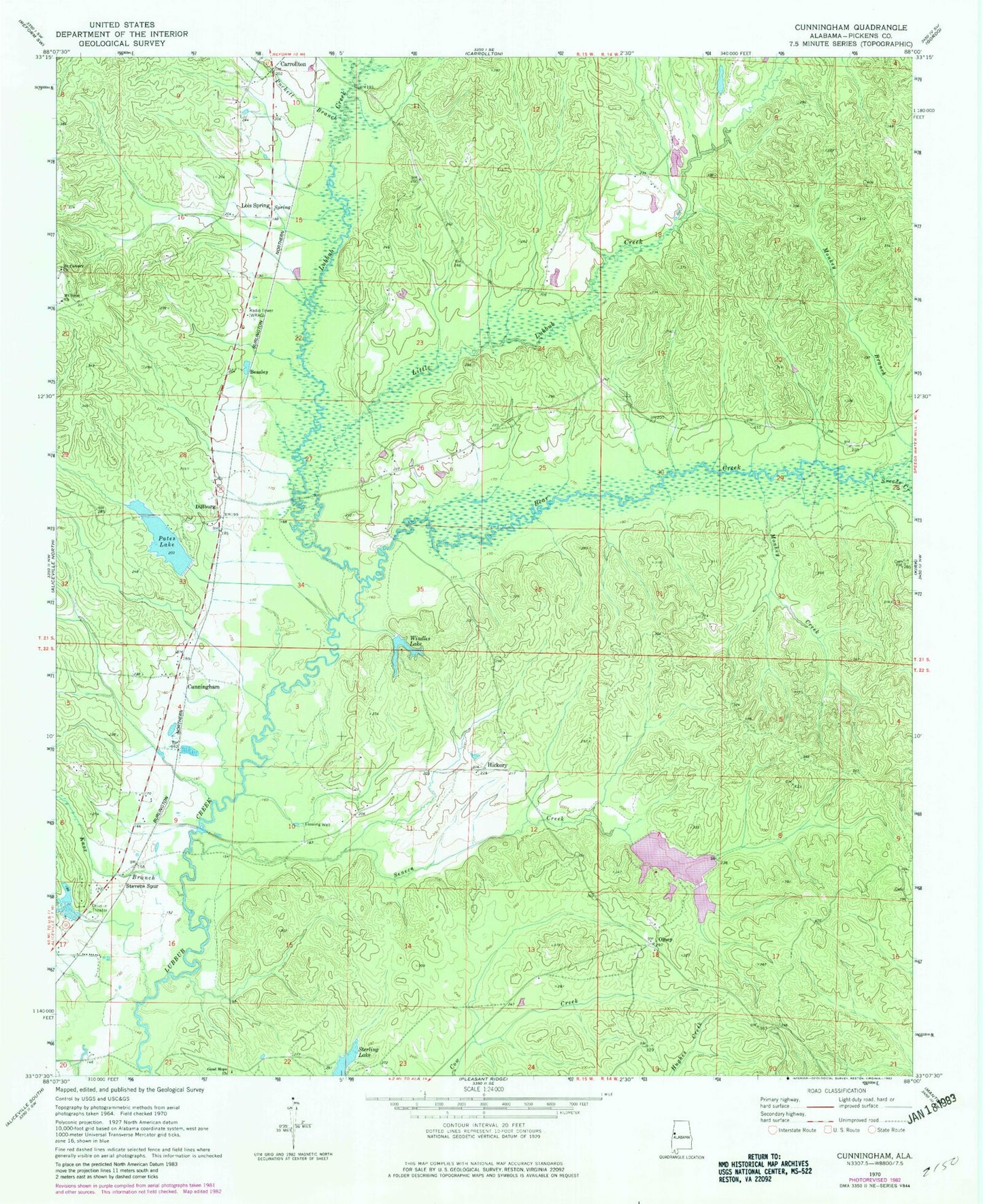
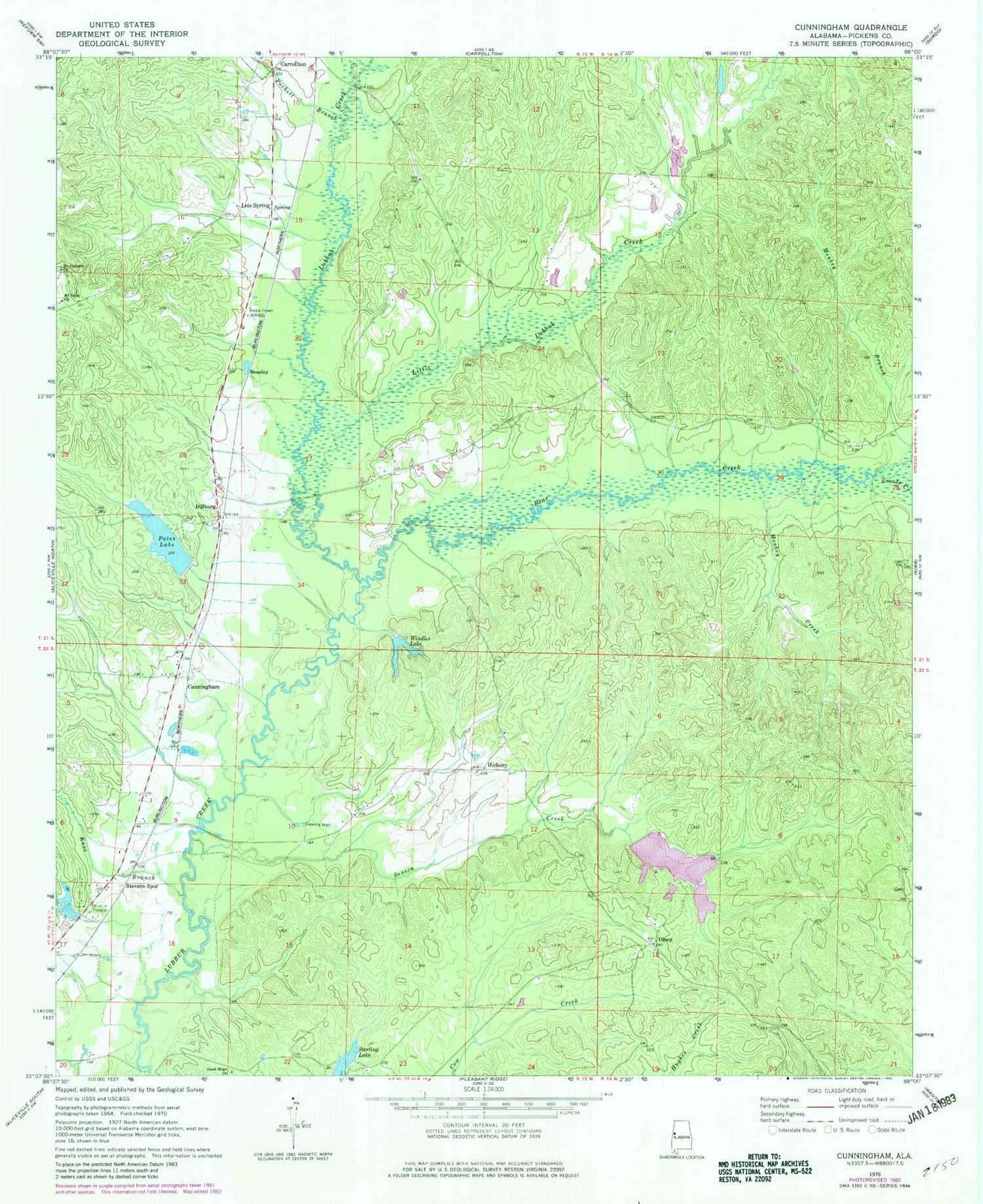
Classic USGS Cunningham Alabama 7.5'x7.5' Topo Map
Couldn't load pickup availability
Historical USGS topographic quad map of Cunningham in the state of Alabama. Map scale may vary for some years, but is generally around 1:24,000. Print size is approximately 24" x 27"
This quadrangle is in the following counties: Pickens.
The map contains contour lines, roads, rivers, towns, and lakes. Printed on high-quality waterproof paper with UV fade-resistant inks, and shipped rolled.
Contains the following named places: Aliceville Division, Bear Creek, Beasley, Bells, Bonners Mill, Cunningham, Dillburg, Good Hope Church, Hickory, Hopewell Hill Cemetery, Hugh Pate Dam, Knox Branch, Little Lubbub Creek, Lois Spring, Monkey Branch, Monkey Creek, Mount Calvary Church, Mount Pleasant Church, Mount Sinai Church, New Salem Church, Olney, P M Johnston Dam Number One, P M Johnston Dam Number Two, P M Johnston Lake Number One, P M Johnston Lake Number Two, Pates Lake, Puckett Branch, Seneca Creek, Sneads Creek, Stevens, Stevens Spur, Unity Cemetery, WAQT-FM (Carrollton), Windles Lake, Windles Lake Dam, WRAG-AM (Carrollton)