MyTopo
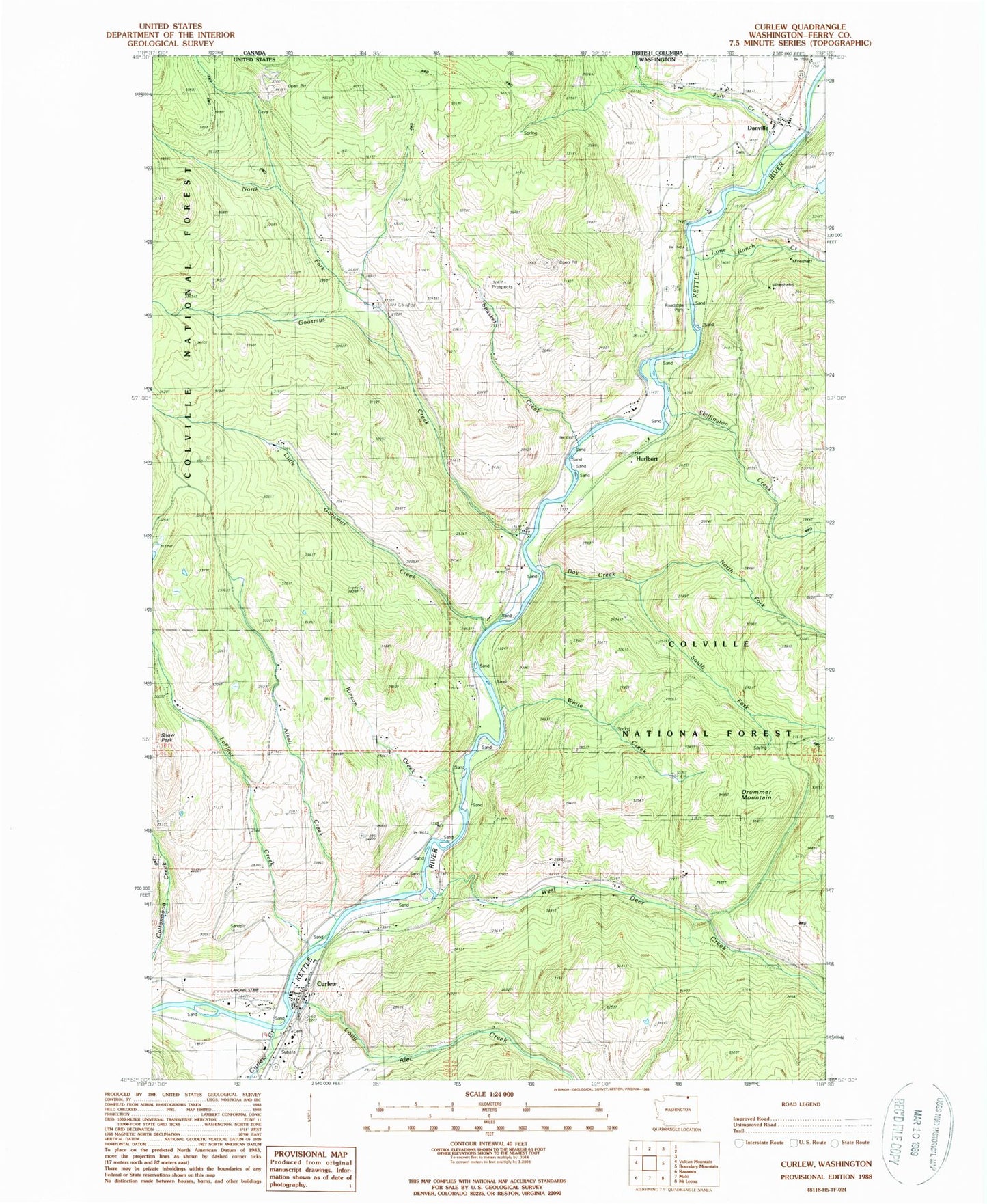
Classic USGS Curlew Washington 7.5'x7.5' Topo Map
Couldn't load pickup availability
Historical USGS topographic quad map of Curlew in the state of Washington. Map scale may vary for some years, but is generally around 1:24,000. Print size is approximately 24" x 27"
This quadrangle is in the following counties: Ferry.
The map contains contour lines, roads, rivers, towns, and lakes. Printed on high-quality waterproof paper with UV fade-resistant inks, and shipped rolled.
Contains the following named places: Alkali Creek, Ansorge Hotel Museum, Curlew, Curlew Administration Site, Curlew Airport, Curlew Bridge, Curlew Census Designated Place, Curlew Creek, Curlew Division, Curlew Post Office, Danville, Danville Census Designated Place, Danville Post Office, Day Creek, Drummer Mountain, Ferry / Okanogan County Fire District 14 Danville, Ferry / Okanogan Fire District 14, Ferry / Okanogan Fire District 14 Curlew, Goosmus Creek, Hurlburt, July Creek, Kettle River Bridge, LaFleur Creek, Little Goosmus Creek, Lone Ranch Creek, Long Alec Creek, North Ferry County Ambulance, North Fork Day Creek, North Fork Goosmus Creek, Rincom Creek, Shasket Creek, Skiffington Creek, South Fork Day Creek, West Deer Creek, White Creek