
MyTopo
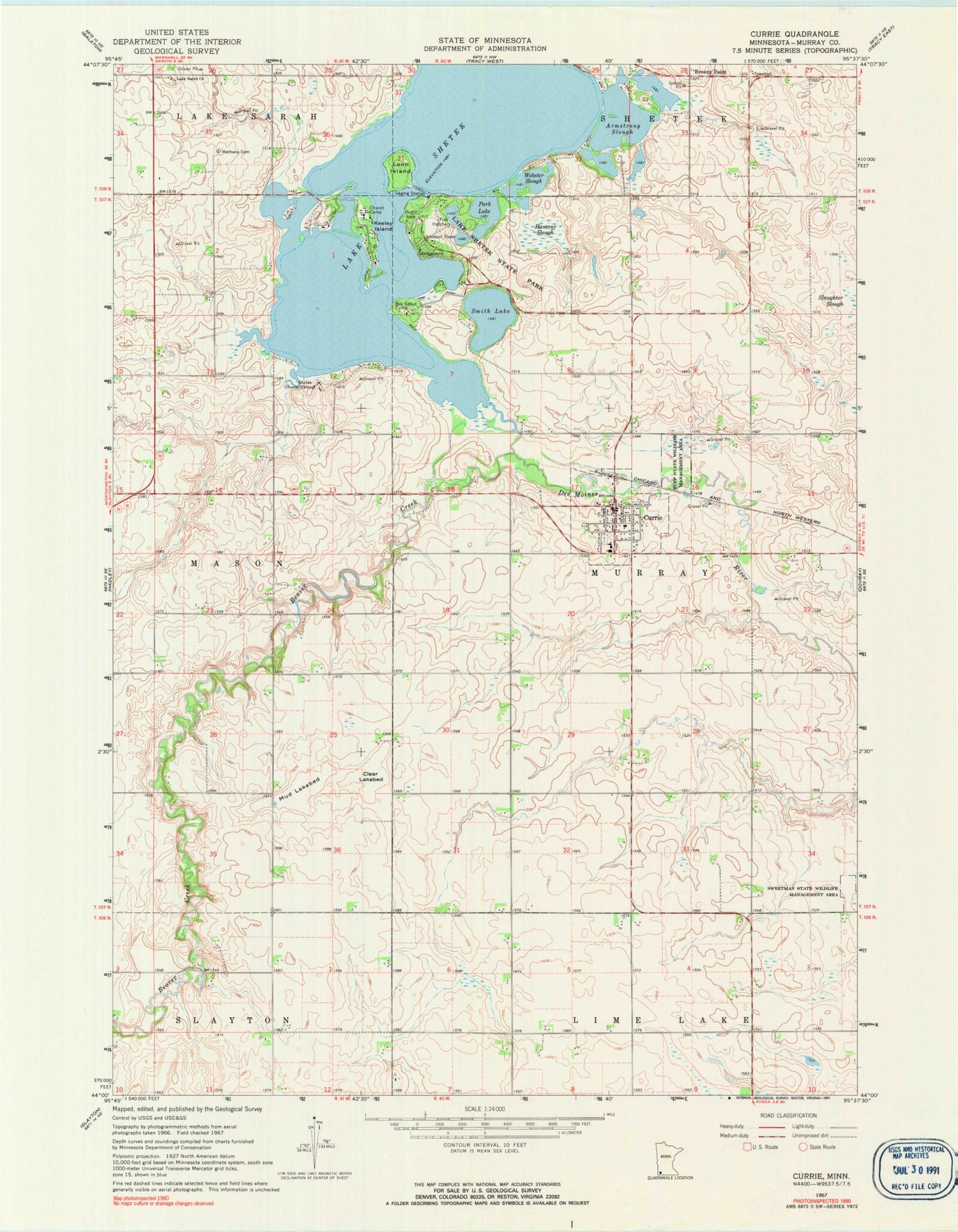
Classic USGS Currie Minnesota 7.5'x7.5' Topo Map
Couldn't load pickup availability
Historical USGS topographic quad map of Currie in the state of Minnesota. Map scale may vary for some years, but is generally around 1:24,000. Print size is approximately 24" x 27"
This quadrangle is in the following counties: Murray.
The map contains contour lines, roads, rivers, towns, and lakes. Printed on high-quality waterproof paper with UV fade-resistant inks, and shipped rolled.
Contains the following named places: Armstrong Slough, Beaver Creek, Bethany Cemetery, Blocks Point, Bowmans Point, Breezy Point, City of Currie, Clear Lakebed, Currie, Currie Clinic, Currie Pioneer Cemetery, Currie Post Office, Currie Volunteer Fire Department, End-O-Line Railroad Park, Hanover Slough, Immaculate Heart of Mary Church, Indian Bay, Keeley Island, Lake Sarah Cemetery, Lake Sarah Church, Lake Shetek, Lake Shetek State Monument, Lake Shetek State Park, Loon Island, Mud Lakebed, Park Lake, Pioneer Cemetery, Rauenhorst Point, Rupp State Wildlife Management Area, Schreiers on Shetek Campground, Shetek Church Camp, Shetek Lake Dam, Smith Lake, Stoney Point, Sweetman State Wildlife Management Area, The Lakes Census Designated Place, Township of Murray, Valhalla Island, Valhalla Island Campground, Webster Slough, Wolf Point, Wolf Point Campground


